Mouscron geodata
Mouscron (Wallonia) is a seat of a third-order administrative division; located in Belgium in Europe/Brussels (GMT+2) time zone. With population of 52,069 people, there are 22 cities with bigger population in this country. Compared to other cities in Belgium, 54.3% of cities are located further ↑North; 93% of cities are located further →East and 51.4% of cities have lower elevation than Mouscron. Note1
Administrative division(s):
- Level 1: Wallonia
- Level 2: Province du Hainaut
- Level 3: Arrondissement de Mouscron
- Level 4: Mouscron


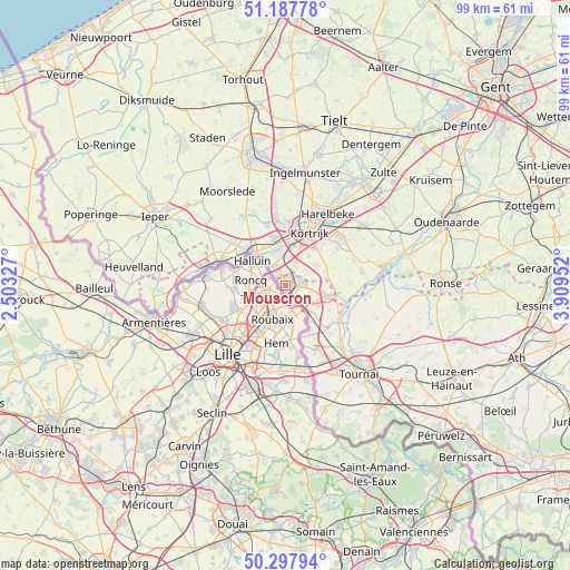
Mouscron GPS coordinates[2]
50° 44' 41.892" North, 3° 12' 23.004" East
| Map corner | latitude | longitude |
|---|---|---|
| Upper-left | 51.18778°, | 2.50327° |
| Center: | 50.74497°, | 3.20639° |
| Lower-right: | 50.29794°, | 3.90952° |
| Map W x H: | 98.9×98.9 km | = 61.5×61.5mi |
| max Lat: | 51.46791° ⇑54.3% North |
| Mouscron: | 50.74497° |
| min Lat: | ⇓45.7% South 49.53771° |
| min Long | Mouscron | max Long |
| 2.59368° | 3.20639° | 6.25749° |
| W 7%⇐ | ⇒93% E |
Elevation
Elevation of Mouscron is 53 m = 174 ft, and this is 46.5 m = 153 ft below average elevation for this country.
| Max E: |
582 m = 1909 ft | 48.6% |
| Avg. | 99.5 m = 326 ft | |
| Mouscron | 53 m = 174 ft | |
Min E: |
1 m = 3 ft | 51.4% |
See also: Mouscron elevation on elevation.city.
Geographical zone
Mouscron is located in North temperate zone (between Tropic of Cancer and the Arctic Circle). Distance of this North polar circle is 1758.9 km =1092.9 mi to North.| Distance of | km | miles | from Mouscron |
|---|---|---|---|
| North Pole | 4364.8 | 2712.2 | to North |
| Arctic Circle | 1758.9 | 1092.9 | to North |
| Tropic Cancer | 3036.4 | 1886.7 | to South |
| Equator | 5642.3 | 3506 | to South |


Nearby cities:
15 places around Mouscron: (largest is in red/bold)
• Avelgem
17.1 km =10.6 mi,  78°
78°
• Celles
18 km =11.2 mi,  101°
101°
• Deerlijk
15.9 km =9.9 mi,  40°
40°
• Estaimpuis
6.2 km =3.9 mi,  135°
135°
• Harelbeke
14.1 km =8.8 mi,  30°
30°
• Izegem
18.8 km =11.7 mi,  1°
1°
• Kortrijk
10.1 km =6.3 mi,  23°
23°
• Kuurne
13 km =8.1 mi, 24°
• Ledegem
13.8 km =8.6 mi,  335°
335°
• Lendelede
15.9 km =9.9 mi,  7°
7°
• Menen
8.3 km =5.2 mi,  314°
314°
• Pecq
11.3 km =7 mi,  125°
125°
• Wervik
12.5 km =7.8 mi,  288°
288°
• Wevelgem
6.7 km =4.2 mi, 335°
• Zwevegem
12 km =7.5 mi,  50°
50°
Sources, notices
• [Note1] Compared only with cities in Belgium existing in our database
• [Src1] Map data: © OpenStreetMap contributors (CC-BY-SA)
• [Src2] Other city data from geonames.org with taken over terms of usage.
• [Src3] Geographical zone / Annual Mean Temperature by Robert A. Rohde @ Wikipedia
