Lebbeke geodata
Lebbeke (Flanders) is a populated place; located in Belgium in Europe/Brussels (GMT+2) time zone. With population of 17,372 people, there are 152 cities with bigger population in this country. Compared to other cities in Belgium, 70.9% of cities are located further ↓South; 70.9% of cities are located further →East and 96% of cities have higher elevation than Lebbeke. Note1
Administrative division(s):
- Level 1: Flanders
- Level 2: Provincie Oost-Vlaanderen
- Level 3: Arrondissement Dendermonde
- Level 4: Lebbeke


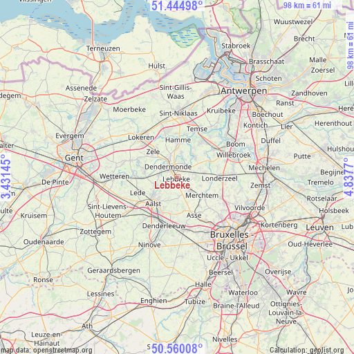
Lebbeke GPS coordinates[2]
51° 0' 16.704" North, 4° 8' 4.452" East
| Map corner | latitude | longitude |
|---|---|---|
| Upper-left | 51.44498°, | 3.43145° |
| Center: | 51.00464°, | 4.13457° |
| Lower-right: | 50.56008°, | 4.8377° |
| Map W x H: | 98.4×98.4 km | = 61.1×61.1mi |
| max Lat: | 51.46791° ⇑29.1% North |
| Lebbeke: | 51.00464° |
| min Lat: | ⇓70.9% South 49.53771° |
| min Long | Lebbeke | max Long |
| 2.59368° | 4.13457° | 6.25749° |
| W 29.1%⇐ | ⇒70.9% E |
Elevation
Elevation of Lebbeke is 6 m = 20 ft, and this is 93.5 m = 307 ft below average elevation for this country.
| Max E: |
582 m = 1909 ft | 96% |
| Avg. | 99.5 m = 326 ft | |
| Lebbeke | 6 m = 20 ft | |
Min E: |
1 m = 3 ft | 4% |
See also: Belgium elevation on elevation.city.
Geographical zone
Lebbeke is located in North temperate zone (between Tropic of Cancer and the Arctic Circle). Distance of this North polar circle is 1730 km =1075 mi to North.| Distance of | km | miles | from Lebbeke |
|---|---|---|---|
| North Pole | 4335.9 | 2694.2 | to North |
| Arctic Circle | 1730 | 1075 | to North |
| Tropic Cancer | 3065.3 | 1904.7 | to South |
| Equator | 5671.2 | 3523.9 | to South |


Nearby cities:
15 places around Lebbeke: (largest is in red/bold)
• Aalst
10.3 km =6.4 mi,  222°
222°
• Asse
11.4 km =7.1 mi,  156°
156°
• Berlare
9.9 km =6.2 mi,  288°
288°
• Bornem
12.8 km =8 mi,  36°
36°
• Buggenhout
4.9 km =3 mi,  75°
75°
• Dendermonde
3.6 km =2.2 mi,  318°
318°
• Hamme
10.4 km =6.5 mi,  0°
0°
• Lede
11.2 km =7 mi,  247°
247°
• Londerzeel
11.8 km =7.3 mi,  89°
89°
• Merchtem
9 km =5.6 mi,  131°
131°
• Opwijk
5.4 km =3.4 mi,  140°
140°
• Sint-Amands
7.8 km =4.8 mi, 42°
• Waasmunster
11.7 km =7.3 mi,  343°
343°
• Wichelen
11 km =6.8 mi,  270°
270°
• Zele
9.5 km =5.9 mi, 315°
Sources, notices
• [Note1] Compared only with cities in Belgium existing in our database
• [Src1] Map data: © OpenStreetMap contributors (CC-BY-SA)
• [Src2] Other city data from geonames.org with taken over terms of usage.
• [Src3] Geographical zone / Annual Mean Temperature by Robert A. Rohde @ Wikipedia
