Herstal geodata
Herstal (Wallonia) is a populated place; located in Belgium in Europe/Brussels (GMT+2) time zone. With population of 36,503 people, there are 34 cities with bigger population in this country. Compared to other cities in Belgium, 63% of cities are located further ↑North; 89.7% of cities are located further ←West and 60.3% of cities have lower elevation than Herstal. Note1
Administrative division(s):
- Level 1: Wallonia
- Level 2: Province de Liège
- Level 3: Arrondissement de Liège
- Level 4: Herstal


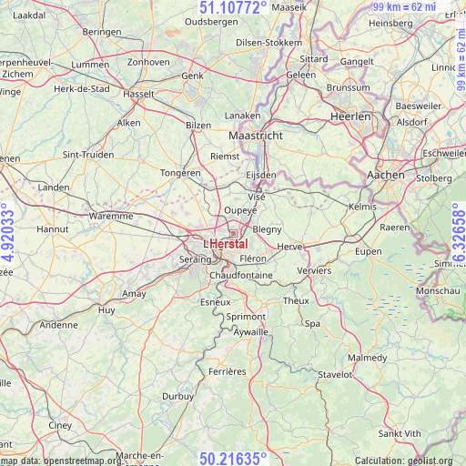
Herstal GPS coordinates[2]
50° 39' 50.94" North, 5° 37' 24.456" East
| Map corner | latitude | longitude |
|---|---|---|
| Upper-left | 51.10772°, | 4.92033° |
| Center: | 50.66415°, | 5.62346° |
| Lower-right: | 50.21635°, | 6.32658° |
| Map W x H: | 99.1×99.1 km | = 61.6×61.6mi |
| max Lat: | 51.46791° ⇑63% North |
| Herstal: | 50.66415° |
| min Lat: | ⇓37% South 49.53771° |
| min Long | Herstal | max Long |
| 2.59368° | 5.62346° | 6.25749° |
| W 89.7%⇐ | ⇒10.3% E |
Elevation
Elevation of Herstal is 81 m = 266 ft, and this is 18.5 m = 61 ft below average elevation for this country.
| Max E: |
582 m = 1909 ft | 39.7% |
| Avg. | 99.5 m = 326 ft | |
| Herstal | 81 m = 266 ft | |
Min E: |
1 m = 3 ft | 60.3% |
See also: Belgium elevation on elevation.city.
Geographical zone
Herstal is located in North temperate zone (between Tropic of Cancer and the Arctic Circle). Distance of this North polar circle is 1767.8 km =1098.5 mi to North.| Distance of | km | miles | from Herstal |
|---|---|---|---|
| North Pole | 4373.7 | 2717.7 | to North |
| Arctic Circle | 1767.8 | 1098.5 | to North |
| Tropic Cancer | 3027.4 | 1881.1 | to South |
| Equator | 5633.3 | 3500.4 | to South |


Nearby cities:
15 places around Herstal: (largest is in red/bold)
• Ans
7.3 km =4.5 mi,  268°
268°
• Awans
11.3 km =7 mi, 272°
• Bassenge
10.6 km =6.6 mi,  354°
354°
• Beyne-Heusay
5.5 km =3.4 mi,  147°
147°
• Blégny
7.2 km =4.5 mi,  82°
82°
• Chaudfontaine
9.1 km =5.7 mi,  175°
175°
• Dalhem
9.1 km =5.7 mi,  53°
53°
• Fléron
6.8 km =4.2 mi,  143°
143°
• Juprelle
8.1 km =5 mi,  306°
306°
• Liège
5.2 km =3.2 mi,  229°
229°
• Oupeye
5.6 km =3.5 mi,  17°
17°
• Saint-Nicolas
7.6 km =4.7 mi,  238°
238°
• Soumagne
10.3 km =6.4 mi,  122°
122°
• Trooz
11.6 km =7.2 mi, 154°
• Visé
9.7 km =6 mi,  33°
33°
Sources, notices
• [Note1] Compared only with cities in Belgium existing in our database
• [Src1] Map data: © OpenStreetMap contributors (CC-BY-SA)
• [Src2] Other city data from geonames.org with taken over terms of usage.
• [Src3] Geographical zone / Annual Mean Temperature by Robert A. Rohde @ Wikipedia
