Visé geodata
Visé (Wallonia) is a populated place; located in Belgium in Europe/Brussels (GMT+2) time zone. With population of 17,054 people, there are 157 cities with bigger population in this country. Compared to other cities in Belgium, 55.1% of cities are located further ↑North; 92.2% of cities are located further ←West and 62.3% of cities have lower elevation than Visé. Note1
Administrative division(s):
- Level 1: Wallonia
- Level 2: Province de Liège
- Level 3: Arrondissement de Liège
- Level 4: Visé


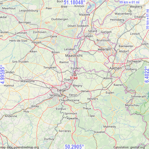
Visé GPS coordinates[2]
50° 44' 15.36" North, 5° 41' 56.652" East
| Map corner | latitude | longitude |
|---|---|---|
| Upper-left | 51.18048°, | 4.99595° |
| Center: | 50.7376°, | 5.69907° |
| Lower-right: | 50.2905°, | 6.4022° |
| Map W x H: | 99×99 km | = 61.5×61.5mi |
| max Lat: | 51.46791° ⇑55.1% North |
| Visé: | 50.7376° |
| min Lat: | ⇓44.9% South 49.53771° |
| min Long | Visé | max Long |
| 2.59368° | 5.69907° | 6.25749° |
| W 92.2%⇐ | ⇒7.8% E |
Elevation
Elevation of Visé is 86 m = 282 ft, and this is 13.5 m = 44 ft below average elevation for this country.
| Max E: |
582 m = 1909 ft | 37.7% |
| Avg. | 99.5 m = 326 ft | |
| Visé | 86 m = 282 ft | |
Min E: |
1 m = 3 ft | 62.3% |
See also: Belgium elevation on elevation.city.
Geographical zone
Visé is located in North temperate zone (between Tropic of Cancer and the Arctic Circle). Distance of this North polar circle is 1759.7 km =1093.4 mi to North.| Distance of | km | miles | from Visé |
|---|---|---|---|
| North Pole | 4365.6 | 2712.7 | to North |
| Arctic Circle | 1759.7 | 1093.4 | to North |
| Tropic Cancer | 3035.6 | 1886.2 | to South |
| Equator | 5641.5 | 3505.5 | to South |


Nearby cities:
15 places around Visé: (largest is in red/bold)
• Ans
15.1 km =9.4 mi,  236°
236°
• Aubel
11.9 km =7.4 mi,  109°
109°
• Bassenge
6.7 km =4.2 mi,  290°
290°
• Beyne-Heusay
13 km =8.1 mi,  190°
190°
• Blégny
7.5 km =4.7 mi,  165°
165°
• Dalhem
3.4 km =2.1 mi,  143°
143°
• Fléron
13.7 km =8.5 mi, 185°
• Herstal
9.7 km =6 mi,  213°
213°
• Herve
12.7 km =7.9 mi,  148°
148°
• Juprelle
12.3 km =7.6 mi,  254°
254°
• Liège
14.8 km =9.2 mi,  218°
218°
• Oupeye
4.7 km =2.9 mi,  232°
232°
• Riemst
10.6 km =6.6 mi,  319°
319°
• Sint-Pieters-Voeren
8.7 km =5.4 mi,  89°
89°
• Soumagne
14.2 km =8.8 mi, 166°
Sources, notices
• [Note1] Compared only with cities in Belgium existing in our database
• [Src1] Map data: © OpenStreetMap contributors (CC-BY-SA)
• [Src2] Other city data from geonames.org with taken over terms of usage.
• [Src3] Geographical zone / Annual Mean Temperature by Robert A. Rohde @ Wikipedia
