Dospat geodata
Dospat (Smolyan) is a seat of a second-order administrative division; located in Bulgaria in Europe/Sofia (GMT+3) time zone. With population of 2,802 people, there are 205 cities with bigger population in this country. Compared to other cities in Bulgaria, 93.3% of cities are located further ↑North; 67.3% of cities are located further →East and 100% of cities have lower elevation than Dospat. Note1


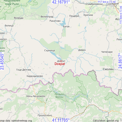
Dospat GPS coordinates[2]
41° 38' 40.632" North, 24° 9' 30.852" East
| Map corner | latitude | longitude |
|---|---|---|
| Upper-left | 42.16791°, | 23.45545° |
| Center: | 41.64462°, | 24.15857° |
| Lower-right: | 41.11705°, | 24.8617° |
| Map W x H: | 116.8×116.8 km | = 72.6×72.6mi |
| max Lat: | 44.16214° ⇑93.3% North |
| Dospat: | 41.64462° |
| min Lat: | ⇓6.7% South 41.32715° |
| min Long | Dospat | max Long |
| 22.52139° | 24.15857° | 28.53429° |
| W 32.7%⇐ | ⇒67.3% E |
Elevation
Elevation of Dospat is 1221 m = 4006 ft, and this is 904.4 m = 2967 ft above average elevation for this country.
| Max E: |
1221 m = 4006 ft | 0% |
| Dospat | 1221 m 4006 ft | |
| Avg. | 316.6 m = 1039 ft | |
Min E: |
1 m = 3 ft | 100% |
See also: Bulgaria elevation on elevation.city.
Geographical zone
Dospat is located in North temperate zone (between Tropic of Cancer and the Arctic Circle). Distance of this Northern Tropic circle is 2024.5 km =1258 mi to South.| Distance of | km | miles | from Dospat |
|---|---|---|---|
| North Pole | 5376.6 | 3340.9 | to North |
| Arctic Circle | 2770.7 | 1721.6 | to North |
| Tropic Cancer | 2024.5 | 1258 | to South |
| Equator | 4630.4 | 2877.2 | to South |


Nearby cities:
15 places around Dospat: (largest is in red/bold)
• Batak
33.5 km =20.8 mi,  8°
8°
• Borino
12 km =7.5 mi,  68°
68°
• Bratsigovo
44.8 km =27.8 mi,  22°
22°
• Chepelare
44.7 km =27.8 mi,  77°
77°
• Devin
22.9 km =14.2 mi,  61°
61°
• Garmen
28.8 km =17.9 mi,  260°
260°
• Gotse Delchev
36.4 km =22.6 mi, 256°
• Gyovren
18.1 km =11.2 mi, 83°
• Hadzhidimovo
27.7 km =17.2 mi,  240°
240°
• Peshtera
44.8 km =27.8 mi, 15°
• Rakitovo
38.9 km =24.2 mi,  351°
351°
• Sarnitsa
15.3 km =9.5 mi,  313°
313°
• Satovcha
14.9 km =9.3 mi, 257°
• Smolyan
46.7 km =29 mi,  99°
99°
• Velingrad
44.8 km =27.8 mi,  341°
341°
Sources, notices
• [Note1] Compared only with cities in Bulgaria existing in our database
• [Src1] Map data: © OpenStreetMap contributors (CC-BY-SA)
• [Src2] Other city data from geonames.org with taken over terms of usage.
• [Src3] Geographical zone / Annual Mean Temperature by Robert A. Rohde @ Wikipedia
