Garmen geodata
Garmen (Blagoevgrad) is a populated place; located in Bulgaria in Europe/Sofia (GMT+3) time zone. With population of 1,838 people, there are 237 cities with bigger population in this country. Compared to other cities in Bulgaria, 95% of cities are located further ↑North; 75.3% of cities are located further →East and 83.3% of cities have lower elevation than Garmen. Note1


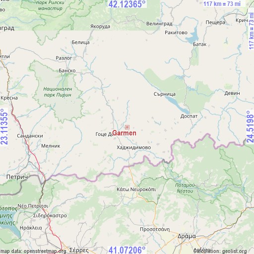
Garmen GPS coordinates[2]
41° 36' 0" North, 23° 49' 0.012" East
| Map corner | latitude | longitude |
|---|---|---|
| Upper-left | 42.12365°, | 23.11355° |
| Center: | 41.6°, | 23.81667° |
| Lower-right: | 41.07206°, | 24.5198° |
| Map W x H: | 116.9×116.9 km | = 72.6×72.6mi |
| max Lat: | 44.16214° ⇑95% North |
| Garmen: | 41.6° |
| min Lat: | ⇓5% South 41.32715° |
| min Long | Garmen | max Long |
| 22.52139° | 23.81667° | 28.53429° |
| W 24.7%⇐ | ⇒75.3% E |
Elevation
Elevation of Garmen is 589 m = 1932 ft, and this is 272.4 m = 894 ft above average elevation for this country.
| Max E: |
1221 m = 4006 ft | 16.7% |
| Garmen | 589 m 1932 ft | |
| Avg. | 316.6 m = 1039 ft | |
Min E: |
1 m = 3 ft | 83.3% |
See also: Bulgaria elevation on elevation.city.
Geographical zone
Garmen is located in North temperate zone (between Tropic of Cancer and the Arctic Circle). Distance of this Northern Tropic circle is 2019.6 km =1254.9 mi to South.| Distance of | km | miles | from Garmen |
|---|---|---|---|
| North Pole | 5381.6 | 3344 | to North |
| Arctic Circle | 2775.7 | 1724.7 | to North |
| Tropic Cancer | 2019.6 | 1254.9 | to South |
| Equator | 4625.5 | 2874.2 | to South |


Nearby cities:
15 places around Garmen: (largest is in red/bold)
• Bansko
38 km =23.6 mi,  314°
314°
• Batak
50.6 km =31.4 mi,  41°
41°
• Belitsa
44.6 km =27.7 mi,  332°
332°
• Borino
40.7 km =25.3 mi,  76°
76°
• Dospat
28.8 km =17.9 mi, 80°
• Gotse Delchev
7.9 km =4.9 mi,  241°
241°
• Gyovren
47 km =29.2 mi, 81°
• Hadzhidimovo
9.7 km =6 mi,  153°
153°
• Rakitovo
48.8 km =30.3 mi,  27°
27°
• Razlog
43.1 km =26.8 mi,  317°
317°
• Sandanski
44.5 km =27.7 mi,  265°
265°
• Sarnitsa
23.1 km =14.4 mi,  48°
48°
• Satovcha
14 km =8.7 mi, 82°
• Velingrad
49.7 km =30.9 mi,  16°
16°
• Yakoruda
48.5 km =30.1 mi,  346°
346°
Sources, notices
• [Note1] Compared only with cities in Bulgaria existing in our database
• [Src1] Map data: © OpenStreetMap contributors (CC-BY-SA)
• [Src2] Other city data from geonames.org with taken over terms of usage.
• [Src3] Geographical zone / Annual Mean Temperature by Robert A. Rohde @ Wikipedia
