Quillacollo geodata
Quillacollo (Cochabamba) is a populated place; located in Bolivia in America/La_Paz (GMT-4) time zone. With population of 87,309 people, there are 9 cities with bigger population in this country. Compared to other cities in Bolivia, 68.3% of cities are located further ↓South; 72% of cities are located further →East and 55.9% of cities have lower elevation than Quillacollo. Note1


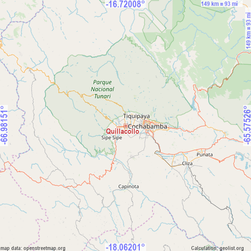
Quillacollo GPS coordinates[2]
17° 23' 32.208" South, 66° 16' 42.168" West
| Map corner | latitude | longitude |
|---|---|---|
| Upper-left | -16.72008°, | -66.98151° |
| Center: | -17.39228°, | -66.27838° |
| Lower-right: | -18.06201°, | -65.57526° |
| Map W x H: | 149.2×149.2 km | = 92.7×92.7mi |
| max Lat: | -9.71828° ⇑31.7% North |
| Quillacollo: | -17.39228° |
| min Lat: | ⇓68.3% South -22.73206° |
| min Long | Quillacollo | max Long |
| -69.14843° | -66.27838° | -57.76667° |
| W 28%⇐ | ⇒72% E |
Elevation
Elevation of Quillacollo is 2559 m = 8396 ft, and this is 547.7 m = 1797 ft above average elevation for this country.
| Max E: |
4732 m = 15525 ft | 44.1% |
| Quillacollo | 2559 m 8396 ft | |
| Avg. | 2011.3 m = 6599 ft | |
Min E: |
92 m = 302 ft | 55.9% |
See also: Quillacollo elevation on elevation.city.
Geographical zone
Quillacollo is located in South Torrid zone (between Equator and Tropic of Capricorn). Distance of this Southern Tropic circle is 672.1 km =417.6 mi to South.| Distance of | km | miles | from Quillacollo |
|---|---|---|---|
| Equator | 1933.8 | 1201.6 | to North |
| Tropic Capricorn | 672.1 | 417.6 | to South |
| Antarctic Circle | 5467.3 | 3397.2 | to South |
| South Pole | 8073.2 | 5016.5 | to South |


Nearby cities:
15 places around Quillacollo: (largest is in red/bold)
• Arani
57.5 km =35.7 mi,  109°
109°
• Capinota
35.5 km =22.1 mi,  176°
176°
• Cliza
42.6 km =26.5 mi,  120°
120°
• Cochabamba
12.9 km =8 mi,  88°
88°
• Colchani
47.3 km =29.4 mi,  280°
280°
• Colomi
43.9 km =27.3 mi,  83°
83°
• Colquiri
90 km =55.9 mi,  270°
270°
• Independencia
66.8 km =41.5 mi,  300°
300°
• Irpa Irpa
36.1 km =22.4 mi, 178°
• Punata
49.9 km =31 mi, 109°
• Quime
109.6 km =68.1 mi,  294°
294°
• Sacaba
25.5 km =15.8 mi, 91°
• Sipe Sipe
12.9 km =8 mi,  240°
240°
• Tarata
36.4 km =22.6 mi,  131°
131°
• Tiquipaya
9 km =5.6 mi,  47°
47°
Sources, notices
• [Note1] Compared only with cities in Bolivia existing in our database
• [Src1] Map data: © OpenStreetMap contributors (CC-BY-SA)
• [Src2] Other city data from geonames.org with taken over terms of usage.
• [Src3] Geographical zone / Annual Mean Temperature by Robert A. Rohde @ Wikipedia
