Independencia geodata
Independencia (Cochabamba) is a seat of a second-order administrative division; located in Bolivia in America/La_Paz (GMT-4) time zone. In our database, there are 117 cities with bigger population. Compared to other cities in Bolivia, 77% of cities are located further ↓South; 75.8% of cities are located further →East and 57.1% of cities have lower elevation than Independencia. Note1


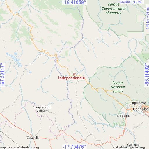
Independencia GPS coordinates[2]
17° 5' 2.004" South, 66° 49' 4.944" West
| Map corner | latitude | longitude |
|---|---|---|
| Upper-left | -16.41059°, | -67.52117° |
| Center: | -17.08389°, | -66.81804° |
| Lower-right: | -17.75476°, | -66.11492° |
| Map W x H: | 149.5×149.5 km | = 92.9×92.9mi |
| max Lat: | -9.71828° ⇑23% North |
| Independencia: | -17.08389° |
| min Lat: | ⇓77% South -22.73206° |
| min Long | Independencia | max Long |
| -69.14843° | -66.81804° | -57.76667° |
| W 24.2%⇐ | ⇒75.8% E |
Elevation
Elevation of Independencia is 2638 m = 8655 ft, and this is 626.7 m = 2056 ft above average elevation for this country.
| Max E: |
4732 m = 15525 ft | 42.9% |
| Independencia | 2638 m 8655 ft | |
| Avg. | 2011.3 m = 6599 ft | |
Min E: |
92 m = 302 ft | 57.1% |
See also: Bolivia elevation on elevation.city.
Geographical zone
Independencia is located in South Torrid zone (between Equator and Tropic of Capricorn). Distance of this Southern Tropic circle is 706.4 km =438.9 mi to South.| Distance of | km | miles | from Independencia |
|---|---|---|---|
| Equator | 1899.6 | 1180.4 | to North |
| Tropic Capricorn | 706.4 | 438.9 | to South |
| Antarctic Circle | 5501.6 | 3418.5 | to South |
| South Pole | 8107.5 | 5037.8 | to South |


Nearby cities:
15 places around Independencia: (largest is in red/bold)
• Belen
83.9 km =52.1 mi,  247°
247°
• Capinota
91.4 km =56.8 mi,  139°
139°
• Cochabamba
78 km =48.5 mi,  115°
115°
• Colchani
28 km =17.4 mi,  157°
157°
• Colquiri
47.2 km =29.3 mi,  223°
223°
• Eucaliptus
92.6 km =57.5 mi,  233°
233°
• Irpa Irpa
91.5 km =56.9 mi, 140°
• Lahuachaca
96.4 km =59.9 mi, 250°
• Quillacollo
66.8 km =41.5 mi, 120°
• Quime
43.8 km =27.2 mi,  284°
284°
• Sacaba
89.9 km =55.9 mi,  112°
112°
• Sipe Sipe
61.5 km =38.2 mi,  131°
131°
• Tarata
102.8 km =63.9 mi, 124°
• Tiquipaya
69.9 km =43.4 mi, 113°
• Viloco
79.2 km =49.2 mi, 280°
Sources, notices
• [Note1] Compared only with cities in Bolivia existing in our database
• [Src1] Map data: © OpenStreetMap contributors (CC-BY-SA)
• [Src2] Other city data from geonames.org with taken over terms of usage.
• [Src3] Geographical zone / Annual Mean Temperature by Robert A. Rohde @ Wikipedia
