Mineros geodata
Mineros (Santa Cruz) is a populated place; located in Bolivia in America/La_Paz (GMT-4) time zone. With population of 14,385 people, there are 34 cities with bigger population in this country. Compared to other cities in Bolivia, 75.8% of cities are located further ↓South; 85.1% of cities are located further ←West and 89.4% of cities have higher elevation than Mineros. Note1


Mineros GPS coordinates[2]
17° 7' 7.536" South, 63° 13' 51.6" West
| Map corner | latitude | longitude |
|---|---|---|
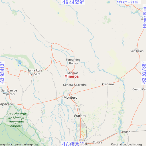
| Upper-left | -16.44559°, | -63.93413° |
| Center: | -17.11876°, | -63.231° |
| Lower-right: | -17.78951°, | -62.52788° |
| Map W x H: | 149.4×149.4 km | = 92.8×92.8mi |
| max Lat: | -9.71828° ⇑24.2% North |
| Mineros: | -17.11876° |
| min Lat: | ⇓75.8% South -22.73206° |
| min Long | Mineros | max Long |
| -69.14843° | -63.231° | -57.76667° |
| W 85.1%⇐ | ⇒14.9% E |
Elevation
Elevation of Mineros is 258 m = 846 ft, and this is 1753.3 m = 5752 ft below average elevation for this country.
| Max E: |
4732 m = 15525 ft | 89.4% |
| Avg. | 2011.3 m = 6599 ft | |
| Mineros | 258 m = 846 ft | |
Min E: |
92 m = 302 ft | 10.6% |
See also: Bolivia elevation on elevation.city.
Geographical zone
Mineros is located in South Torrid zone (between Equator and Tropic of Capricorn). Distance of this Southern Tropic circle is 702.5 km =436.5 mi to South.| Distance of | km | miles | from Mineros |
|---|---|---|---|
| Equator | 1903.4 | 1182.7 | to North |
| Tropic Capricorn | 702.5 | 436.5 | to South |
| Antarctic Circle | 5497.7 | 3416.1 | to South |
| South Pole | 8103.6 | 5035.3 | to South |


Nearby cities:
15 places around Mineros: (largest is in red/bold)
• Buena Vista
60.1 km =37.3 mi,  231°
231°
• La Bélgica
48 km =29.8 mi,  178°
178°
• Los Negros
71.6 km =44.5 mi,  197°
197°
• Montero
24.5 km =15.2 mi, 184°
• Okinawa Número Uno
45.8 km =28.5 mi,  106°
106°
• Pailón
78.1 km =48.5 mi,  139°
139°
• Portachuelo
31.1 km =19.3 mi,  213°
213°
• Puearto Pailas
75.1 km =46.7 mi, 143°
• Puesto de Pailas
74.7 km =46.4 mi, 142°
• San Carlos
63.4 km =39.4 mi,  240°
240°
• San Juan del Surutú
64.2 km =39.9 mi, 230°
• Santa Cruz de la Sierra
74.4 km =46.2 mi, 175°
• Santa Rosa del Sara
38.7 km =24 mi,  271°
271°
• Villa Yapacaní
71.2 km =44.2 mi, 243°
• Warnes
44.7 km =27.8 mi,  171°
171°
Sources, notices
• [Note1] Compared only with cities in Bolivia existing in our database
• [Src1] Map data: © OpenStreetMap contributors (CC-BY-SA)
• [Src2] Other city data from geonames.org with taken over terms of usage.
• [Src3] Geographical zone / Annual Mean Temperature by Robert A. Rohde @ Wikipedia
