Villa Yapacaní geodata
Villa Yapacaní (Santa Cruz) is a populated place; located in Bolivia in America/La_Paz (GMT-4) time zone. With population of 18,187 people, there are 29 cities with bigger population in this country. Compared to other cities in Bolivia, 66.5% of cities are located further ↓South; 73.3% of cities are located further ←West and 86.3% of cities have higher elevation than Villa Yapacaní. Note1


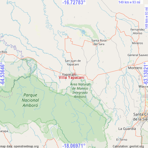
Villa Yapacaní GPS coordinates[2]
17° 24' 0" South, 63° 49' 59.988" West
| Map corner | latitude | longitude |
|---|---|---|
| Upper-left | -16.72783°, | -64.53646° |
| Center: | -17.4°, | -63.83333° |
| Lower-right: | -18.06971°, | -63.13021° |
| Map W x H: | 149.2×149.2 km | = 92.7×92.7mi |
| max Lat: | -9.71828° ⇑33.5% North |
| Villa Yapacaní: | -17.4° |
| min Lat: | ⇓66.5% South -22.73206° |
| min Long | Villa Yapacaní | max Long |
| -69.14843° | -63.83333° | -57.76667° |
| W 73.3%⇐ | ⇒26.7% E |
Elevation
Elevation of Villa Yapacaní is 297 m = 974 ft, and this is 1714.3 m = 5624 ft below average elevation for this country.
| Max E: |
4732 m = 15525 ft | 86.3% |
| Avg. | 2011.3 m = 6599 ft | |
| Villa Yapacaní | 297 m = 974 ft | |
Min E: |
92 m = 302 ft | 13.7% |
See also: Bolivia elevation on elevation.city.
Geographical zone
Villa Yapacaní is located in South Torrid zone (between Equator and Tropic of Capricorn). Distance of this Southern Tropic circle is 671.2 km =417.1 mi to South.| Distance of | km | miles | from Villa Yapacaní |
|---|---|---|---|
| Equator | 1934.7 | 1202.2 | to North |
| Tropic Capricorn | 671.2 | 417.1 | to South |
| Antarctic Circle | 5466.5 | 3396.7 | to South |
| South Pole | 8072.4 | 5016 | to South |


Nearby cities:
15 places around Villa Yapacaní: (largest is in red/bold)
• Buena Vista
18.4 km =11.4 mi,  110°
110°
• La Bélgica
67.5 km =41.9 mi,  104°
104°
• Limoncito
83.5 km =51.9 mi,  147°
147°
• Los Negros
56.3 km =35 mi,  131°
131°
• Mairana
81.1 km =50.4 mi,  189°
189°
• Mineros
71.2 km =44.2 mi,  63°
63°
• Montero
62.2 km =38.6 mi,  83°
83°
• Portachuelo
47.1 km =29.3 mi, 83°
• San Carlos
8.8 km =5.5 mi,  90°
90°
• San Juan del Surutú
16.9 km =10.5 mi,  123°
123°
• Santa Cruz de la Sierra
81.4 km =50.6 mi, 121°
• Santa Rita
81.2 km =50.5 mi,  140°
140°
• Santa Rosa del Sara
41.1 km =25.5 mi,  38°
38°
• Santiago del Torno
80.9 km =50.3 mi, 143°
• Warnes
71.8 km =44.6 mi, 100°
Sources, notices
• [Note1] Compared only with cities in Bolivia existing in our database
• [Src1] Map data: © OpenStreetMap contributors (CC-BY-SA)
• [Src2] Other city data from geonames.org with taken over terms of usage.
• [Src3] Geographical zone / Annual Mean Temperature by Robert A. Rohde @ Wikipedia
