San Juan del Surutú geodata
San Juan del Surutú (Santa Cruz) is a populated place; located in Bolivia in America/La_Paz (GMT-4) time zone. With population of 3,707 people, there are 74 cities with bigger population in this country. Compared to other cities in Bolivia, 64.6% of cities are located further ↓South; 75.2% of cities are located further ←West and 81.4% of cities have higher elevation than San Juan del Surutú. Note1


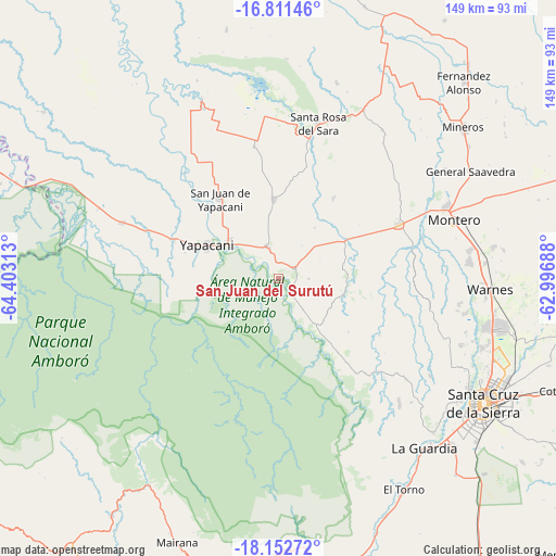
San Juan del Surutú GPS coordinates[2]
17° 28' 59.988" South, 63° 42' 0" West
| Map corner | latitude | longitude |
|---|---|---|
| Upper-left | -16.81146°, | -64.40313° |
| Center: | -17.48333°, | -63.7° |
| Lower-right: | -18.15272°, | -62.99688° |
| Map W x H: | 149.1×149.1 km | = 92.6×92.6mi |
| max Lat: | -9.71828° ⇑35.4% North |
| San Juan del Surutú: | -17.48333° |
| min Lat: | ⇓64.6% South -22.73206° |
| min Long | San Juan del Su | max Long |
| -69.14843° | -63.7° | -57.76667° |
| W 75.2%⇐ | ⇒24.8% E |
Elevation
Elevation of San Juan del Surutú is 320 m = 1050 ft, and this is 1691.3 m = 5549 ft below average elevation for this country.
| Max E: |
4732 m = 15525 ft | 81.4% |
| Avg. | 2011.3 m = 6599 ft | |
| San Juan del Surutú | 320 m = 1050 ft | |
Min E: |
92 m = 302 ft | 18.6% |
See also: Bolivia elevation on elevation.city.
Geographical zone
San Juan del Surutú is located in South Torrid zone (between Equator and Tropic of Capricorn). Distance of this Southern Tropic circle is 662 km =411.3 mi to South.| Distance of | km | miles | from San Juan del Surutú |
|---|---|---|---|
| Equator | 1944 | 1207.9 | to North |
| Tropic Capricorn | 662 | 411.3 | to South |
| Antarctic Circle | 5457.2 | 3390.9 | to South |
| South Pole | 8063.1 | 5010.2 | to South |


Nearby cities:
15 places around San Juan del Surutú: (largest is in red/bold)
• Buena Vista
4.1 km =2.5 mi,  47°
47°
• Jorochito
69.8 km =43.4 mi,  155°
155°
• La Bélgica
51.8 km =32.2 mi,  98°
98°
• Limoncito
68.4 km =42.5 mi,  152°
152°
• Los Negros
39.6 km =24.6 mi,  134°
134°
• Mineros
64.2 km =39.9 mi, 50°
• Montero
50.3 km =31.3 mi,  71°
71°
• Portachuelo
35.7 km =22.2 mi, 65°
• San Carlos
10.7 km =6.6 mi,  330°
330°
• Santa Cruz de la Sierra
64.5 km =40.1 mi,  121°
121°
• Santa Rita
65.3 km =40.6 mi, 145°
• Santa Rosa del Sara
43.1 km =26.8 mi,  14°
14°
• Santiago del Torno
65.4 km =40.6 mi, 148°
• Villa Yapacaní
16.9 km =10.5 mi,  303°
303°
• Warnes
56.6 km =35.2 mi,  93°
93°
Sources, notices
• [Note1] Compared only with cities in Bolivia existing in our database
• [Src1] Map data: © OpenStreetMap contributors (CC-BY-SA)
• [Src2] Other city data from geonames.org with taken over terms of usage.
• [Src3] Geographical zone / Annual Mean Temperature by Robert A. Rohde @ Wikipedia
