Lintaca geodata
Lintaca (Chuquisaca) is a seat of a fourth-order administrative division; located in Bolivia in America/La_Paz (GMT-4) time zone. In our database, there are 117 cities with bigger population. Compared to other cities in Bolivia, 89.4% of cities are located further ↑North; 54.7% of cities are located further →East and 75.8% of cities have lower elevation than Lintaca. Note1
Administrative division(s):
- Level 1: Chuquisaca
- Level 2: Provincia Nor Cinti
- Level 3: Camargo
- Level 4: Lintaca


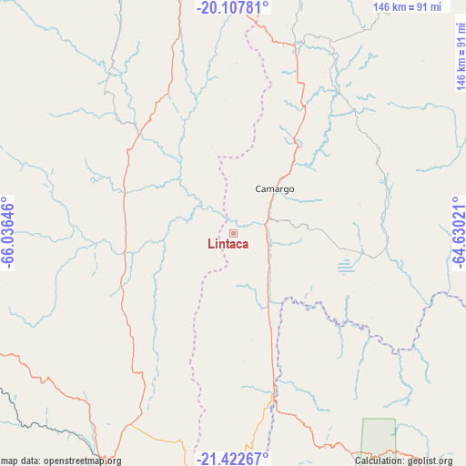
Lintaca GPS coordinates[2]
20° 46' 0.012" South, 65° 19' 59.988" West
| Map corner | latitude | longitude |
|---|---|---|
| Upper-left | -20.10781°, | -66.03646° |
| Center: | -20.76667°, | -65.33333° |
| Lower-right: | -21.42267°, | -64.63021° |
| Map W x H: | 146.2×146.2 km | = 90.8×90.8mi |
| max Lat: | -9.71828° ⇑89.4% North |
| Lintaca: | -20.76667° |
| min Lat: | ⇓10.6% South -22.73206° |
| min Long | Lintaca | max Long |
| -69.14843° | -65.33333° | -57.76667° |
| W 45.3%⇐ | ⇒54.7% E |
Elevation
Elevation of Lintaca is 3189 m = 10463 ft, and this is 1177.7 m = 3864 ft above average elevation for this country.
| Max E: |
4732 m = 15525 ft | 24.2% |
| Lintaca | 3189 m 10463 ft | |
| Avg. | 2011.3 m = 6599 ft | |
Min E: |
92 m = 302 ft | 75.8% |
See also: Bolivia elevation on elevation.city.
Geographical zone
Lintaca is located in South Torrid zone (between Equator and Tropic of Capricorn). Distance of this Southern Tropic circle is 296.9 km =184.5 mi to South.| Distance of | km | miles | from Lintaca |
|---|---|---|---|
| Equator | 2309 | 1434.7 | to North |
| Tropic Capricorn | 296.9 | 184.5 | to South |
| Antarctic Circle | 5092.1 | 3164.1 | to South |
| South Pole | 7698 | 4783.3 | to South |


Nearby cities:
15 places around Lintaca: (largest is in red/bold)
• Atocha
94.2 km =58.5 mi,  258°
258°
• Camargo
19.1 km =11.9 mi,  42°
42°
• Culpina
40.9 km =25.4 mi,  98°
98°
• Huajlaya
83.6 km =51.9 mi,  77°
77°
• La Cueva
48.7 km =30.3 mi,  112°
112°
• Las Carreras
50.8 km =31.6 mi,  165°
165°
• Las Carreras
54 km =33.6 mi, 174°
• Pilaya
63.9 km =39.7 mi, 108°
• Salitre
45.2 km =28.1 mi, 106°
• San Francisco
66.1 km =41.1 mi,  85°
85°
• San Juan
55.7 km =34.6 mi,  176°
176°
• Santa Bárbara
76.3 km =47.4 mi, 257°
• Santa Elena
62.1 km =38.6 mi,  67°
67°
• Tupiza
85.2 km =52.9 mi,  207°
207°
• Villa Charcas
46.9 km =29.1 mi, 84°
Sources, notices
• [Note1] Compared only with cities in Bolivia existing in our database
• [Src1] Map data: © OpenStreetMap contributors (CC-BY-SA)
• [Src2] Other city data from geonames.org with taken over terms of usage.
• [Src3] Geographical zone / Annual Mean Temperature by Robert A. Rohde @ Wikipedia
