Las Carreras geodata
Las Carreras (Chuquisaca) is a seat of a fourth-order administrative division; located in Bolivia in America/La_Paz (GMT-4) time zone. In our database, there are 117 cities with bigger population. Compared to other cities in Bolivia, 94.4% of cities are located further ↑North; 50.3% of cities are located further ←West and 50.3% of cities have higher elevation than Las Carreras. Note1
Administrative division(s):
- Level 1: Chuquisaca
- Level 2: Provincia Sud Cinti
- Level 3: Las Carreras
- Level 4: Las Carreras


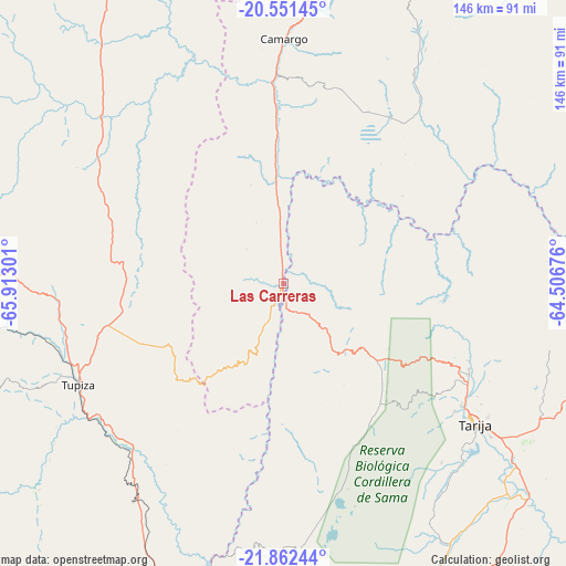
Las Carreras GPS coordinates[2]
21° 12' 30.24" South, 65° 12' 35.568" West
| Map corner | latitude | longitude |
|---|---|---|
| Upper-left | -20.55145°, | -65.91301° |
| Center: | -21.2084°, | -65.20988° |
| Lower-right: | -21.86244°, | -64.50676° |
| Map W x H: | 145.8×145.8 km | = 90.6×90.6mi |
| max Lat: | -9.71828° ⇑94.4% North |
| Las Carreras: | -21.2084° |
| min Lat: | ⇓5.6% South -22.73206° |
| min Long | Las Carreras | max Long |
| -69.14843° | -65.20988° | -57.76667° |
| W 50.3%⇐ | ⇒49.7% E |
Elevation
Elevation of Las Carreras is 2328 m = 7638 ft, and this is 316.7 m = 1039 ft above average elevation for this country.
| Max E: |
4732 m = 15525 ft | 50.3% |
| Las Carreras | 2328 m 7638 ft | |
| Avg. | 2011.3 m = 6599 ft | |
Min E: |
92 m = 302 ft | 49.7% |
See also: Bolivia elevation on elevation.city.
Geographical zone
Las Carreras is located in South Torrid zone (between Equator and Tropic of Capricorn). Distance of this Southern Tropic circle is 247.8 km =154 mi to South.| Distance of | km | miles | from Las Carreras |
|---|---|---|---|
| Equator | 2358.2 | 1465.3 | to North |
| Tropic Capricorn | 247.8 | 154 | to South |
| Antarctic Circle | 5043 | 3133.6 | to South |
| South Pole | 7648.9 | 4752.8 | to South |


Nearby cities:
15 places around Las Carreras: (largest is in red/bold)
• Camargo
63.1 km =39.2 mi,  0°
0°
• Culpina
50.9 km =31.6 mi,  32°
32°
• Huajlaya
96.3 km =59.8 mi,  45°
45°
• La Cueva
44.4 km =27.6 mi, 46°
• Las Carreras
8.9 km =5.5 mi,  238°
238°
• Lintaca
50.8 km =31.6 mi,  345°
345°
• Pilaya
55.7 km =34.6 mi,  58°
58°
• Salitre
47.2 km =29.3 mi,  40°
40°
• San Francisco
76.1 km =47.3 mi, 44°
• San Juan
11.4 km =7.1 mi, 235°
• Santa Bárbara
93 km =57.8 mi,  290°
290°
• Santa Elena
85.6 km =53.2 mi, 31°
• Tarija
61.6 km =38.3 mi,  126°
126°
• Tupiza
58.8 km =36.5 mi, 243°
• Villa Charcas
63.7 km =39.6 mi, 32°
Sources, notices
• [Note1] Compared only with cities in Bolivia existing in our database
• [Src1] Map data: © OpenStreetMap contributors (CC-BY-SA)
• [Src2] Other city data from geonames.org with taken over terms of usage.
• [Src3] Geographical zone / Annual Mean Temperature by Robert A. Rohde @ Wikipedia
