Tupiza geodata
Tupiza (Potosí) is a populated place; located in Bolivia in America/La_Paz (GMT-4) time zone. With population of 22,233 people, there are 23 cities with bigger population in this country. Compared to other cities in Bolivia, 96.9% of cities are located further ↑North; 62.1% of cities are located further →East and 68.3% of cities have lower elevation than Tupiza. Note1


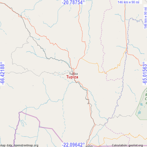
Tupiza GPS coordinates[2]
21° 26' 36.42" South, 65° 43' 7.5" West
| Map corner | latitude | longitude |
|---|---|---|
| Upper-left | -20.78754°, | -66.42188° |
| Center: | -21.44345°, | -65.71875° |
| Lower-right: | -22.09642°, | -65.01563° |
| Map W x H: | 145.5×145.5 km | = 90.4×90.4mi |
| max Lat: | -9.71828° ⇑96.9% North |
| Tupiza: | -21.44345° |
| min Lat: | ⇓3.1% South -22.73206° |
| min Long | Tupiza | max Long |
| -69.14843° | -65.71875° | -57.76667° |
| W 37.9%⇐ | ⇒62.1% E |
Elevation
Elevation of Tupiza is 2961 m = 9715 ft, and this is 949.7 m = 3116 ft above average elevation for this country.
| Max E: |
4732 m = 15525 ft | 31.7% |
| Tupiza | 2961 m 9715 ft | |
| Avg. | 2011.3 m = 6599 ft | |
Min E: |
92 m = 302 ft | 68.3% |
See also: Bolivia elevation on elevation.city.
Geographical zone
Tupiza is located in South Torrid zone (between Equator and Tropic of Capricorn). Distance of this Southern Tropic circle is 221.6 km =137.7 mi to South.| Distance of | km | miles | from Tupiza |
|---|---|---|---|
| Equator | 2384.3 | 1481.5 | to North |
| Tropic Capricorn | 221.6 | 137.7 | to South |
| Antarctic Circle | 5016.9 | 3117.4 | to South |
| South Pole | 7622.8 | 4736.6 | to South |


Nearby cities:
15 places around Tupiza: (largest is in red/bold)
• Atocha
76.9 km =47.8 mi,  317°
317°
• Camargo
103.8 km =64.5 mi,  30°
30°
• Culpina
105.8 km =65.7 mi,  49°
49°
• La Cueva
102.1 km =63.4 mi,  56°
56°
• Las Carreras
50 km =31.1 mi, 64°
• Las Carreras
58.8 km =36.5 mi, 63°
• Lintaca
85.2 km =52.9 mi, 27°
• Pilaya
114.4 km =71.1 mi, 61°
• Salitre
103.9 km =64.6 mi, 53°
• San Francisco
133 km =82.6 mi, 52°
• San Juan
47.6 km =29.6 mi,  65°
65°
• Santa Bárbara
67.9 km =42.2 mi,  329°
329°
• Tarija
102.9 km =63.9 mi,  95°
95°
• Villa Charcas
117.9 km =73.3 mi, 47°
• Villazón
72.7 km =45.2 mi,  169°
169°
Sources, notices
• [Note1] Compared only with cities in Bolivia existing in our database
• [Src1] Map data: © OpenStreetMap contributors (CC-BY-SA)
• [Src2] Other city data from geonames.org with taken over terms of usage.
• [Src3] Geographical zone / Annual Mean Temperature by Robert A. Rohde @ Wikipedia
