Atocha geodata
Atocha (Potosí) is a populated place; located in Bolivia in America/La_Paz (GMT-4) time zone. With population of 1,833 people, there are 107 cities with bigger population in this country. Compared to other cities in Bolivia, 92.5% of cities are located further ↑North; 70.2% of cities are located further →East and 81.4% of cities have lower elevation than Atocha. Note1


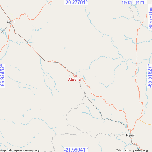
Atocha GPS coordinates[2]
20° 56' 6.54" South, 66° 13' 17.004" West
| Map corner | latitude | longitude |
|---|---|---|
| Upper-left | -20.27701°, | -66.92452° |
| Center: | -20.93515°, | -66.22139° |
| Lower-right: | -21.59041°, | -65.51827° |
| Map W x H: | 146×146 km | = 90.7×90.7mi |
| max Lat: | -9.71828° ⇑92.5% North |
| Atocha: | -20.93515° |
| min Lat: | ⇓7.5% South -22.73206° |
| min Long | Atocha | max Long |
| -69.14843° | -66.22139° | -57.76667° |
| W 29.8%⇐ | ⇒70.2% E |
Elevation
Elevation of Atocha is 3675 m = 12057 ft, and this is 1663.7 m = 5458 ft above average elevation for this country.
| Max E: |
4732 m = 15525 ft | 18.6% |
| Atocha | 3675 m 12057 ft | |
| Avg. | 2011.3 m = 6599 ft | |
Min E: |
92 m = 302 ft | 81.4% |
See also: Bolivia elevation on elevation.city.
Geographical zone
Atocha is located in South Torrid zone (between Equator and Tropic of Capricorn). Distance of this Southern Tropic circle is 278.1 km =172.8 mi to South.| Distance of | km | miles | from Atocha |
|---|---|---|---|
| Equator | 2327.8 | 1446.4 | to North |
| Tropic Capricorn | 278.1 | 172.8 | to South |
| Antarctic Circle | 5073.4 | 3152.5 | to South |
| South Pole | 7679.3 | 4771.7 | to South |


Nearby cities:
15 places around Atocha: (largest is in red/bold)
• Camargo
110.2 km =68.5 mi,  72°
72°
• Colchani
102.4 km =63.6 mi,  313°
313°
• Culpina
133.2 km =82.8 mi,  84°
84°
• La Cueva
137.2 km =85.3 mi,  89°
89°
• Las Carreras
103.4 km =64.2 mi,  109°
109°
• Las Carreras
109.3 km =67.9 mi, 106°
• Lintaca
94.2 km =58.5 mi, 78°
• Pilaya
152.8 km =94.9 mi, 90°
• Salitre
135.6 km =84.3 mi, 87°
• San Juan
102.4 km =63.6 mi, 111°
• Santa Bárbara
17.9 km =11.1 mi, 83°
• Tupiza
76.9 km =47.8 mi,  137°
137°
• Uyuni
82.1 km =51 mi, 310°
• Villa Charcas
140.9 km =87.6 mi, 80°
• Villazón
143.5 km =89.2 mi,  153°
153°
Sources, notices
• [Note1] Compared only with cities in Bolivia existing in our database
• [Src1] Map data: © OpenStreetMap contributors (CC-BY-SA)
• [Src2] Other city data from geonames.org with taken over terms of usage.
• [Src3] Geographical zone / Annual Mean Temperature by Robert A. Rohde @ Wikipedia
