Huajlaya geodata
Huajlaya (Chuquisaca) is a seat of a fourth-order administrative division; located in Bolivia in America/La_Paz (GMT-4) time zone. In our database, there are 117 cities with bigger population. Compared to other cities in Bolivia, 86.3% of cities are located further ↑North; 64.6% of cities are located further ←West and 54.7% of cities have higher elevation than Huajlaya. Note1
Administrative division(s):
- Level 1: Chuquisaca
- Level 2: Provincia Nor Cinti
- Level 3: Incahuasi
- Level 4: Huajlaya


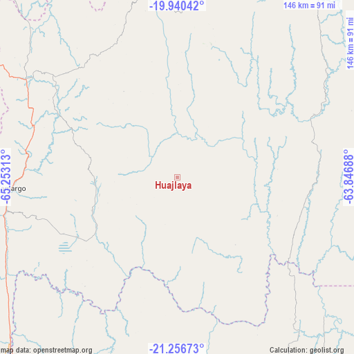
Huajlaya GPS coordinates[2]
20° 36' 0" South, 64° 33' 0" West
| Map corner | latitude | longitude |
|---|---|---|
| Upper-left | -19.94042°, | -65.25313° |
| Center: | -20.6°, | -64.55° |
| Lower-right: | -21.25673°, | -63.84688° |
| Map W x H: | 146.4×146.4 km | = 91×91mi |
| max Lat: | -9.71828° ⇑86.3% North |
| Huajlaya: | -20.6° |
| min Lat: | ⇓13.7% South -22.73206° |
| min Long | Huajlaya | max Long |
| -69.14843° | -64.55° | -57.76667° |
| W 64.6%⇐ | ⇒35.4% E |
Elevation
Elevation of Huajlaya is 2083 m = 6834 ft, and this is 71.7 m = 235 ft above average elevation for this country.
| Max E: |
4732 m = 15525 ft | 54.7% |
| Huajlaya | 2083 m 6834 ft | |
| Avg. | 2011.3 m = 6599 ft | |
Min E: |
92 m = 302 ft | 45.3% |
See also: Bolivia elevation on elevation.city.
Geographical zone
Huajlaya is located in South Torrid zone (between Equator and Tropic of Capricorn). Distance of this Southern Tropic circle is 315.4 km =196 mi to South.| Distance of | km | miles | from Huajlaya |
|---|---|---|---|
| Equator | 2290.5 | 1423.3 | to North |
| Tropic Capricorn | 315.4 | 196 | to South |
| Antarctic Circle | 5110.7 | 3175.6 | to South |
| South Pole | 7716.6 | 4794.9 | to South |


Nearby cities:
15 places around Huajlaya: (largest is in red/bold)
• Azurduy
56.7 km =35.2 mi,  14°
14°
• Camargo
68.7 km =42.7 mi,  266°
266°
• Culpina
48 km =29.8 mi,  238°
238°
• La Cueva
51.9 km =32.2 mi,  224°
224°
• Las Carreras
96.3 km =59.8 mi,  225°
225°
• Las Carreras
105 km =65.2 mi, 226°
• Lintaca
83.6 km =51.9 mi,  257°
257°
• Pilaya
44.1 km =27.4 mi,  208°
208°
• Rosario del Ingre
67.7 km =42.1 mi,  88°
88°
• Salitre
49.5 km =30.8 mi, 230°
• San Francisco
20.3 km =12.6 mi, 230°
• San Juan
107.5 km =66.8 mi, 226°
• Santa Elena
24.9 km =15.5 mi,  282°
282°
• Tarija
105.7 km =65.7 mi,  190°
190°
• Villa Charcas
37.4 km =23.2 mi,  248°
248°
Sources, notices
• [Note1] Compared only with cities in Bolivia existing in our database
• [Src1] Map data: © OpenStreetMap contributors (CC-BY-SA)
• [Src2] Other city data from geonames.org with taken over terms of usage.
• [Src3] Geographical zone / Annual Mean Temperature by Robert A. Rohde @ Wikipedia
