Soledade geodata
Soledade (Paraíba) is a populated place; located in Brazil in America/Fortaleza (GMT-3) time zone. With population of 8,090 people, there are 1769 cities with bigger population in this country. Compared to other cities in Brazil, 80.3% of cities are located further ↓South; 91.4% of cities are located further ←West and 65.1% of cities have lower elevation than Soledade. Note1


Soledade GPS coordinates[2]
7° 3' 25.992" South, 36° 21' 46.008" West
| Map corner | latitude | longitude |
|---|---|---|
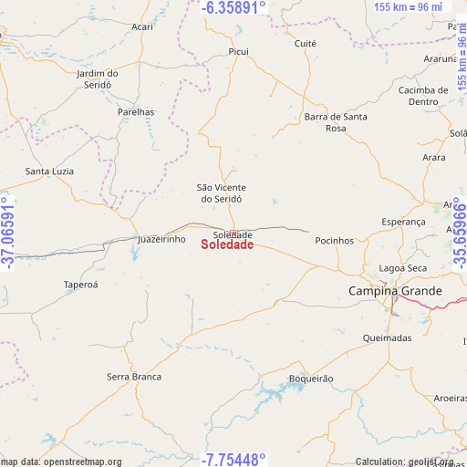
| Upper-left | -6.35891°, | -37.06591° |
| Center: | -7.05722°, | -36.36278° |
| Lower-right: | -7.75448°, | -35.65966° |
| Map W x H: | 155.2×155.2 km | = 96.4×96.4mi |
| max Lat: | 2.81972° ⇑19.7% North |
| Soledade: | -7.05722° |
| min Lat: | ⇓80.3% South -33.69111° |
| min Long | Soledade | max Long |
| -72.89583° | -36.36278° | -32.41083° |
| W 91.4%⇐ | ⇒8.6% E |
Elevation
Elevation of Soledade is 526 m = 1726 ft, and this is 145.1 m = 476 ft above average elevation for this country.
| Max E: |
1603 m = 5259 ft | 34.9% |
| Soledade | 526 m 1726 ft | |
| Avg. | 380.9 m = 1250 ft | |
Min E: |
0 m = 0 ft | 65.1% |
See also: Brazil elevation on elevation.city.
Geographical zone
Soledade is located in South Torrid zone (between Equator and Tropic of Capricorn). Distance of Equator is 784.7 km =487.6 mi to North.| Distance of | km | miles | from Soledade |
|---|---|---|---|
| Equator | 784.7 | 487.6 | to North |
| Tropic Capricorn | 1821.2 | 1131.6 | to South |
| Antarctic Circle | 6616.5 | 4111.3 | to South |
| South Pole | 9222.4 | 5730.5 | to South |


Nearby cities:
15 places around Soledade: (largest is in red/bold)
• Alagoa Nova
66.7 km =41.4 mi,  91°
91°
• Boqueirão
53.6 km =33.3 mi,  151°
151°
• Campina Grande
56.5 km =35.1 mi,  109°
109°
• Cuité
67.8 km =42.1 mi,  19°
19°
• Esperança
55.9 km =34.7 mi, 87°
• Lagoa Seca
57.6 km =35.8 mi,  102°
102°
• Massaranduba
65.3 km =40.6 mi, 104°
• Nova Floresta
69.2 km =43 mi,  14°
14°
• Parelhas
52.4 km =32.6 mi,  321°
321°
• Picuí
60.8 km =37.8 mi,  1°
1°
• Pocinhos
33.4 km =20.8 mi, 93°
• Puxinanã
45.9 km =28.5 mi, 104°
• Remígio
65.4 km =40.6 mi,  79°
79°
• Santa Luzia
64.7 km =40.2 mi,  288°
288°
• Taperoá
53.8 km =33.4 mi,  251°
251°
Sources, notices
• [Note1] Compared only with cities in Brazil existing in our database
• [Src1] Map data: © OpenStreetMap contributors (CC-BY-SA)
• [Src2] Other city data from geonames.org with taken over terms of usage.
• [Src3] Geographical zone / Annual Mean Temperature by Robert A. Rohde @ Wikipedia
