Massaranduba geodata
Massaranduba (Paraíba) is a populated place; located in Brazil in America/Fortaleza (GMT-3) time zone. With population of 3,153 people, there are 1986 cities with bigger population in this country. Compared to other cities in Brazil, 79.4% of cities are located further ↓South; 93.8% of cities are located further ←West and 51.6% of cities have lower elevation than Massaranduba. Note1


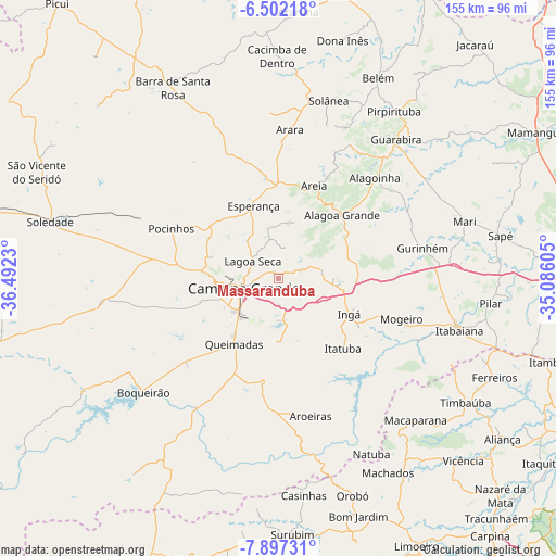
Massaranduba GPS coordinates[2]
7° 12' 1.008" South, 35° 47' 21.012" West
| Map corner | latitude | longitude |
|---|---|---|
| Upper-left | -6.50218°, | -36.4923° |
| Center: | -7.20028°, | -35.78917° |
| Lower-right: | -7.89731°, | -35.08605° |
| Map W x H: | 155.1×155.1 km | = 96.4×96.4mi |
| max Lat: | 2.81972° ⇑20.6% North |
| Massaranduba: | -7.20028° |
| min Lat: | ⇓79.4% South -33.69111° |
| min Long | Massaranduba | max Long |
| -72.89583° | -35.78917° | -32.41083° |
| W 93.8%⇐ | ⇒6.2% E |
Elevation
Elevation of Massaranduba is 371 m = 1217 ft, and this is 9.9 m = 32 ft below average elevation for this country.
| Max E: |
1603 m = 5259 ft | 48.4% |
| Avg. | 380.9 m = 1250 ft | |
| Massaranduba | 371 m = 1217 ft | |
Min E: |
0 m = 0 ft | 51.6% |
See also: Brazil elevation on elevation.city.
Geographical zone
Massaranduba is located in South Torrid zone (between Equator and Tropic of Capricorn). Distance of Equator is 800.6 km =497.5 mi to North.| Distance of | km | miles | from Massaranduba |
|---|---|---|---|
| Equator | 800.6 | 497.5 | to North |
| Tropic Capricorn | 1805.3 | 1121.8 | to South |
| Antarctic Circle | 6600.6 | 4101.4 | to South |
| South Pole | 9206.5 | 5720.7 | to South |


Nearby cities:
15 places around Massaranduba: (largest is in red/bold)
• Alagoa Grande
18.2 km =11.3 mi,  75°
75°
• Alagoa Nova
14.8 km =9.2 mi,  13°
13°
• Alagoinha
38.7 km =24 mi,  44°
44°
• Areia
28.5 km =17.7 mi,  22°
22°
• Aroeiras
39.4 km =24.5 mi,  166°
166°
• Campina Grande
10.7 km =6.6 mi,  251°
251°
• Esperança
20.1 km =12.5 mi,  338°
338°
• Fagundes
17.3 km =10.7 mi, 174°
• Ingá
22.3 km =13.9 mi,  113°
113°
• Itatuba
26.3 km =16.3 mi,  137°
137°
• Lagoa Seca
7.8 km =4.8 mi,  294°
294°
• Mogeiro
35.9 km =22.3 mi, 107°
• Pocinhos
33 km =20.5 mi, 294°
• Puxinanã
19.4 km =12.1 mi,  282°
282°
• Remígio
28.2 km =17.5 mi,  1°
1°
Sources, notices
• [Note1] Compared only with cities in Brazil existing in our database
• [Src1] Map data: © OpenStreetMap contributors (CC-BY-SA)
• [Src2] Other city data from geonames.org with taken over terms of usage.
• [Src3] Geographical zone / Annual Mean Temperature by Robert A. Rohde @ Wikipedia
