Lagoa Seca geodata
Lagoa Seca (Paraíba) is a populated place; located in Brazil in America/Fortaleza (GMT-3) time zone. With population of 8,103 people, there are 1766 cities with bigger population in this country. Compared to other cities in Brazil, 79.6% of cities are located further ↓South; 93.3% of cities are located further ←West and 75.4% of cities have lower elevation than Lagoa Seca. Note1


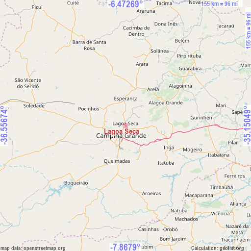
Lagoa Seca GPS coordinates[2]
7° 10' 14.988" South, 35° 51' 12.996" West
| Map corner | latitude | longitude |
|---|---|---|
| Upper-left | -6.47269°, | -36.55674° |
| Center: | -7.17083°, | -35.85361° |
| Lower-right: | -7.8679°, | -35.15049° |
| Map W x H: | 155.1×155.1 km | = 96.4×96.4mi |
| max Lat: | 2.81972° ⇑20.4% North |
| Lagoa Seca: | -7.17083° |
| min Lat: | ⇓79.6% South -33.69111° |
| min Long | Lagoa Seca | max Long |
| -72.89583° | -35.85361° | -32.41083° |
| W 93.3%⇐ | ⇒6.7% E |
Elevation
Elevation of Lagoa Seca is 631 m = 2070 ft, and this is 250.1 m = 821 ft above average elevation for this country.
| Max E: |
1603 m = 5259 ft | 24.6% |
| Lagoa Seca | 631 m 2070 ft | |
| Avg. | 380.9 m = 1250 ft | |
Min E: |
0 m = 0 ft | 75.4% |
See also: Brazil elevation on elevation.city.
Geographical zone
Lagoa Seca is located in South Torrid zone (between Equator and Tropic of Capricorn). Distance of Equator is 797.3 km =495.4 mi to North.| Distance of | km | miles | from Lagoa Seca |
|---|---|---|---|
| Equator | 797.3 | 495.4 | to North |
| Tropic Capricorn | 1808.6 | 1123.8 | to South |
| Antarctic Circle | 6603.9 | 4103.5 | to South |
| South Pole | 9209.7 | 5722.6 | to South |


Nearby cities:
15 places around Lagoa Seca: (largest is in red/bold)
• Alagoa Grande
24.7 km =15.3 mi,  86°
86°
• Alagoa Nova
15.3 km =9.5 mi,  43°
43°
• Alagoinha
42 km =26.1 mi,  54°
54°
• Arara
39.5 km =24.5 mi,  15°
15°
• Areia
29.2 km =18.1 mi, 37°
• Campina Grande
7.3 km =4.5 mi,  204°
204°
• Esperança
15.3 km =9.5 mi,  358°
358°
• Fagundes
22.2 km =13.8 mi,  157°
157°
• Ingá
30.1 km =18.7 mi,  113°
113°
• Itatuba
33.7 km =20.9 mi,  132°
132°
• Massaranduba
7.8 km =4.8 mi, 114°
• Mogeiro
43.7 km =27.2 mi, 109°
• Pocinhos
25.2 km =15.7 mi,  294°
294°
• Puxinanã
11.8 km =7.3 mi,  275°
275°
• Remígio
26.2 km =16.3 mi, 17°
Sources, notices
• [Note1] Compared only with cities in Brazil existing in our database
• [Src1] Map data: © OpenStreetMap contributors (CC-BY-SA)
• [Src2] Other city data from geonames.org with taken over terms of usage.
• [Src3] Geographical zone / Annual Mean Temperature by Robert A. Rohde @ Wikipedia
