Alagoa Grande geodata
Alagoa Grande (Paraíba) is a populated place; located in Brazil in America/Fortaleza (GMT-3) time zone. With population of 16,406 people, there are 1130 cities with bigger population in this country. Compared to other cities in Brazil, 79.7% of cities are located further ↓South; 94.9% of cities are located further ←West and 51.6% of cities have higher elevation than Alagoa Grande. Note1


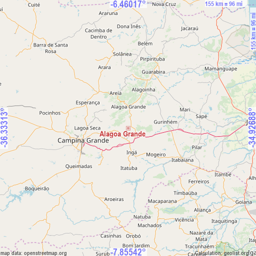
Alagoa Grande GPS coordinates[2]
7° 9' 29.988" South, 35° 37' 48" West
| Map corner | latitude | longitude |
|---|---|---|
| Upper-left | -6.46017°, | -36.33313° |
| Center: | -7.15833°, | -35.63° |
| Lower-right: | -7.85542°, | -34.92688° |
| Map W x H: | 155.1×155.1 km | = 96.4×96.4mi |
| max Lat: | 2.81972° ⇑20.3% North |
| Alagoa Grande: | -7.15833° |
| min Lat: | ⇓79.7% South -33.69111° |
| min Long | Alagoa Grande | max Long |
| -72.89583° | -35.63° | -32.41083° |
| W 94.9%⇐ | ⇒5.1% E |
Elevation
Elevation of Alagoa Grande is 334 m = 1096 ft, and this is 46.9 m = 154 ft below average elevation for this country.
| Max E: |
1603 m = 5259 ft | 51.6% |
| Avg. | 380.9 m = 1250 ft | |
| Alagoa Grande | 334 m = 1096 ft | |
Min E: |
0 m = 0 ft | 48.4% |
See also: Brazil elevation on elevation.city.
Geographical zone
Alagoa Grande is located in South Torrid zone (between Equator and Tropic of Capricorn). Distance of Equator is 795.9 km =494.5 mi to North.| Distance of | km | miles | from Alagoa Grande |
|---|---|---|---|
| Equator | 795.9 | 494.5 | to North |
| Tropic Capricorn | 1810 | 1124.7 | to South |
| Antarctic Circle | 6605.2 | 4104.3 | to South |
| South Pole | 9211.1 | 5723.5 | to South |


Nearby cities:
15 places around Alagoa Grande: (largest is in red/bold)
• Alagoa Nova
17.2 km =10.7 mi,  304°
304°
• Alagoinha
25 km =15.5 mi,  22°
22°
• Areia
22.7 km =14.1 mi,  342°
342°
• Campina Grande
28.8 km =17.9 mi,  253°
253°
• Esperança
28.7 km =17.8 mi, 299°
• Fagundes
27.1 km =16.8 mi,  216°
216°
• Gurinhém
23 km =14.3 mi,  80°
80°
• Ingá
13.9 km =8.6 mi,  168°
168°
• Itatuba
24.1 km =15 mi,  179°
179°
• Lagoa Seca
24.7 km =15.3 mi,  266°
266°
• Massaranduba
18.2 km =11.3 mi,  255°
255°
• Mogeiro
22.8 km =14.2 mi,  133°
133°
• Mulungu
23.8 km =14.8 mi,  51°
51°
• Remígio
28.8 km =17.9 mi,  324°
324°
• Salgado de São Félix
30.4 km =18.9 mi,  136°
136°
Sources, notices
• [Note1] Compared only with cities in Brazil existing in our database
• [Src1] Map data: © OpenStreetMap contributors (CC-BY-SA)
• [Src2] Other city data from geonames.org with taken over terms of usage.
• [Src3] Geographical zone / Annual Mean Temperature by Robert A. Rohde @ Wikipedia
