Brejo geodata
Brejo (Maranhão) is a populated place; located in Brazil in America/Fortaleza (GMT-3) time zone. With population of 11,636 people, there are 1511 cities with bigger population in this country. Compared to other cities in Brazil, 92.8% of cities are located further ↓South; 61.9% of cities are located further ←West and 76.1% of cities have higher elevation than Brejo. Note1


Brejo GPS coordinates[2]
3° 41' 3.984" South, 42° 45' 1.008" West
| Map corner | latitude | longitude |
|---|---|---|
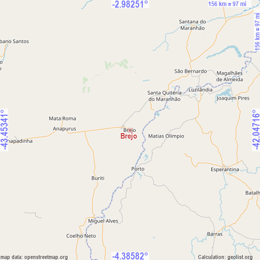
| Upper-left | -2.98251°, | -43.45341° |
| Center: | -3.68444°, | -42.75028° |
| Lower-right: | -4.38582°, | -42.04716° |
| Map W x H: | 156×156 km | = 96.9×96.9mi |
| max Lat: | 2.81972° ⇑7.2% North |
| Brejo: | -3.68444° |
| min Lat: | ⇓92.8% South -33.69111° |
| min Long | Brejo | max Long |
| -72.89583° | -42.75028° | -32.41083° |
| W 61.9%⇐ | ⇒38.1% E |
Elevation
Elevation of Brejo is 70 m = 230 ft, and this is 310.9 m = 1020 ft below average elevation for this country.
| Max E: |
1603 m = 5259 ft | 76.1% |
| Avg. | 380.9 m = 1250 ft | |
| Brejo | 70 m = 230 ft | |
Min E: |
0 m = 0 ft | 23.9% |
See also: Brazil elevation on elevation.city.
Geographical zone
Brejo is located in South Torrid zone (between Equator and Tropic of Capricorn). Distance of Equator is 409.7 km =254.6 mi to North.| Distance of | km | miles | from Brejo |
|---|---|---|---|
| Equator | 409.7 | 254.6 | to North |
| Tropic Capricorn | 2196.2 | 1364.7 | to South |
| Antarctic Circle | 6991.5 | 4344.3 | to South |
| South Pole | 9597.4 | 5963.5 | to South |


Nearby cities:
15 places around Brejo: (largest is in red/bold)
• Barras
80.2 km =49.8 mi,  140°
140°
• Barreirinhas
103.6 km =64.4 mi,  355°
355°
• Batalha
83.9 km =52.1 mi,  116°
116°
• Chapadinha
68 km =42.3 mi,  264°
264°
• Coelho Neto
70 km =43.5 mi,  204°
204°
• Esperantina
62.2 km =38.6 mi,  112°
112°
• Luzilândia
49.1 km =30.5 mi,  59°
59°
• Matias Olímpio
21.9 km =13.6 mi,  99°
99°
• Miguel Alves
55.9 km =34.7 mi, 196°
• Porto
23.7 km =14.7 mi,  169°
169°
• Santa Quitéria do Maranhão
29.4 km =18.3 mi,  50°
50°
• São Benedito do Rio Preto
94.8 km =58.9 mi,  294°
294°
• São Bernardo
51.5 km =32 mi, 45°
• União
101 km =62.8 mi,  187°
187°
• Urbano Santos
89.8 km =55.8 mi,  306°
306°
Sources, notices
• [Note1] Compared only with cities in Brazil existing in our database
• [Src1] Map data: © OpenStreetMap contributors (CC-BY-SA)
• [Src2] Other city data from geonames.org with taken over terms of usage.
• [Src3] Geographical zone / Annual Mean Temperature by Robert A. Rohde @ Wikipedia
