União geodata
União (Piauí) is a populated place; located in Brazil in America/Fortaleza (GMT-3) time zone. With population of 15,677 people, there are 1178 cities with bigger population in this country. Compared to other cities in Brazil, 89.4% of cities are located further ↓South; 61.2% of cities are located further ←West and 77.6% of cities have higher elevation than União. Note1


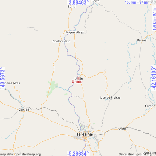
União GPS coordinates[2]
4° 35' 8.988" South, 42° 51' 51.012" West
| Map corner | latitude | longitude |
|---|---|---|
| Upper-left | -3.88463°, | -43.5673° |
| Center: | -4.58583°, | -42.86417° |
| Lower-right: | -5.28634°, | -42.16105° |
| Map W x H: | 155.9×155.9 km | = 96.9×96.9mi |
| max Lat: | 2.81972° ⇑10.6% North |
| União: | -4.58583° |
| min Lat: | ⇓89.4% South -33.69111° |
| min Long | União | max Long |
| -72.89583° | -42.86417° | -32.41083° |
| W 61.2%⇐ | ⇒38.8% E |
Elevation
Elevation of União is 60 m = 197 ft, and this is 320.9 m = 1053 ft below average elevation for this country.
| Max E: |
1603 m = 5259 ft | 77.6% |
| Avg. | 380.9 m = 1250 ft | |
| União | 60 m = 197 ft | |
Min E: |
0 m = 0 ft | 22.4% |
See also: Brazil elevation on elevation.city.
Geographical zone
União is located in South Torrid zone (between Equator and Tropic of Capricorn). Distance of Equator is 509.9 km =316.8 mi to North.| Distance of | km | miles | from União |
|---|---|---|---|
| Equator | 509.9 | 316.8 | to North |
| Tropic Capricorn | 2096 | 1302.4 | to South |
| Antarctic Circle | 6891.3 | 4282.1 | to South |
| South Pole | 9497.2 | 5901.3 | to South |


Nearby cities:
15 places around União: (largest is in red/bold)
• Alto Longá
103.5 km =64.3 mi,  135°
135°
• Altos
67.3 km =41.8 mi, 138°
• Barras
73.7 km =45.8 mi,  58°
58°
• Brejo
101 km =62.8 mi,  7°
7°
• Campo Maior
81.6 km =50.7 mi,  109°
109°
• Caxias
62.4 km =38.8 mi,  240°
240°
• Coelho Neto
40.1 km =24.9 mi,  335°
335°
• Demerval Lobão
88.4 km =54.9 mi,  166°
166°
• Esperantina
103.3 km =64.2 mi,  42°
42°
• José de Freitas
37.2 km =23.1 mi,  120°
120°
• Matias Olímpio
102.6 km =63.8 mi,  19°
19°
• Miguel Alves
46.9 km =29.1 mi,  355°
355°
• Porto
78.9 km =49 mi, 12°
• Teresina
56.4 km =35 mi, 172°
• Timon
56.6 km =35.2 mi,  176°
176°
Sources, notices
• [Note1] Compared only with cities in Brazil existing in our database
• [Src1] Map data: © OpenStreetMap contributors (CC-BY-SA)
• [Src2] Other city data from geonames.org with taken over terms of usage.
• [Src3] Geographical zone / Annual Mean Temperature by Robert A. Rohde @ Wikipedia
