Trindade geodata
Trindade (Goiás) is a populated place; located in Brazil in America/Sao_Paulo (GMT-3) time zone. With population of 97,521 people, there are 240 cities with bigger population in this country. Compared to other cities in Brazil, 51.7% of cities are located further ↓South; 75.5% of cities are located further →East and 86.1% of cities have lower elevation than Trindade. Note1


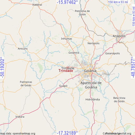
Trindade GPS coordinates[2]
16° 38' 57.984" South, 49° 29' 20.004" West
| Map corner | latitude | longitude |
|---|---|---|
| Upper-left | -15.97462°, | -50.19202° |
| Center: | -16.64944°, | -49.48889° |
| Lower-right: | -17.32189°, | -48.78577° |
| Map W x H: | 149.8×149.8 km | = 93.1×93.1mi |
| max Lat: | 2.81972° ⇑48.3% North |
| Trindade: | -16.64944° |
| min Lat: | ⇓51.7% South -33.69111° |
| min Long | Trindade | max Long |
| -72.89583° | -49.48889° | -32.41083° |
| W 24.5%⇐ | ⇒75.5% E |
Elevation
Elevation of Trindade is 768 m = 2520 ft, and this is 387.1 m = 1270 ft above average elevation for this country.
| Max E: |
1603 m = 5259 ft | 13.9% |
| Trindade | 768 m 2520 ft | |
| Avg. | 380.9 m = 1250 ft | |
Min E: |
0 m = 0 ft | 86.1% |
See also: Trindade elevation on elevation.city.
Geographical zone
Trindade is located in South Torrid zone (between Equator and Tropic of Capricorn). Distance of this Southern Tropic circle is 754.7 km =468.9 mi to South.| Distance of | km | miles | from Trindade |
|---|---|---|---|
| Equator | 1851.2 | 1150.3 | to North |
| Tropic Capricorn | 754.7 | 468.9 | to South |
| Antarctic Circle | 5549.9 | 3448.5 | to South |
| South Pole | 8155.8 | 5067.8 | to South |


Nearby cities:
15 places around Trindade: (largest is in red/bold)
• Anicuns
54.6 km =33.9 mi,  292°
292°
• Anápolis
67.5 km =41.9 mi,  57°
57°
• Aparecida de Goiânia
32.5 km =20.2 mi,  126°
126°
• Bela Vista de Goiás
67.4 km =41.9 mi,  122°
122°
• Goianira
18.3 km =11.4 mi,  21°
21°
• Goianápolis
51.9 km =32.2 mi,  72°
72°
• Goiânia
25.2 km =15.7 mi,  97°
97°
• Guapó
20.7 km =12.9 mi,  192°
192°
• Hidrolândia
44.5 km =27.7 mi,  141°
141°
• Inhumas
32.4 km =20.1 mi,  358°
358°
• Itaberaí
77.9 km =48.4 mi,  333°
333°
• Nerópolis
39.5 km =24.5 mi,  46°
46°
• Palmeiras de Goiás
49.6 km =30.8 mi,  249°
249°
• Petrolina de Goiás
63.7 km =39.6 mi,  14°
14°
• Senador Canedo
42.7 km =26.5 mi, 98°
Sources, notices
• [Note1] Compared only with cities in Brazil existing in our database
• [Src1] Map data: © OpenStreetMap contributors (CC-BY-SA)
• [Src2] Other city data from geonames.org with taken over terms of usage.
• [Src3] Geographical zone / Annual Mean Temperature by Robert A. Rohde @ Wikipedia
