Alegrete geodata
Alegrete (Rio Grande do Sul) is a populated place; located in Brazil in America/Sao_Paulo (GMT-3) time zone. With population of 87,236 people, there are 266 cities with bigger population in this country. Compared to other cities in Brazil, 97.9% of cities are located further ↑North; 94.9% of cities are located further →East and 71.9% of cities have higher elevation than Alegrete. Note1


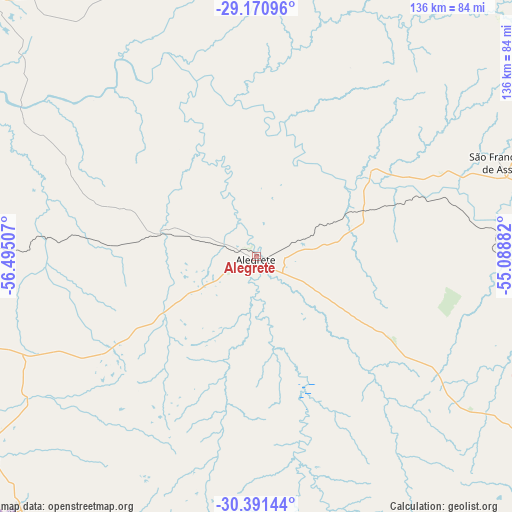
Alegrete GPS coordinates[2]
29° 46' 59.016" South, 55° 47' 30.984" West
| Map corner | latitude | longitude |
|---|---|---|
| Upper-left | -29.17096°, | -56.49507° |
| Center: | -29.78306°, | -55.79194° |
| Lower-right: | -30.39144°, | -55.08882° |
| Map W x H: | 135.7×135.7 km | = 84.3×84.3mi |
| max Lat: | 2.81972° ⇑97.9% North |
| Alegrete: | -29.78306° |
| min Lat: | ⇓2.1% South -33.69111° |
| min Long | Alegrete | max Long |
| -72.89583° | -55.79194° | -32.41083° |
| W 5.1%⇐ | ⇒94.9% E |
Elevation
Elevation of Alegrete is 107 m = 351 ft, and this is 273.9 m = 899 ft below average elevation for this country.
| Max E: |
1603 m = 5259 ft | 71.9% |
| Avg. | 380.9 m = 1250 ft | |
| Alegrete | 107 m = 351 ft | |
Min E: |
0 m = 0 ft | 28.1% |
See also: Alegrete elevation on elevation.city.
Geographical zone
Alegrete is located in South temperate zone (between Tropic of Capricorn and the Antarctic Circle). Distance of this Southern Tropic circle is 705.6 km =438.4 mi to North.| Distance of | km | miles | from Alegrete |
|---|---|---|---|
| Equator | 3311.6 | 2057.7 | to North |
| Tropic Capricorn | 705.6 | 438.4 | to North |
| Antarctic Circle | 4089.6 | 2541.2 | to South |
| South Pole | 6695.5 | 4160.4 | to South |


Nearby cities:
15 places around Alegrete: (largest is in red/bold)
• Cacequi
93.9 km =58.3 mi,  96°
96°
• Dom Pedrito
171.2 km =106.4 mi,  141°
141°
• Itaqui
103.8 km =64.5 mi,  314°
314°
• Quaraí
92.4 km =57.4 mi,  223°
223°
• Rosário do Sul
99.7 km =62 mi,  122°
122°
• Santa Maria
192 km =119.3 mi,  86°
86°
• Santana do Livramento
125.7 km =78.1 mi,  168°
168°
• Santiago
111.1 km =69 mi,  53°
53°
• São Borja
126.5 km =78.6 mi,  350°
350°
• São Francisco de Assis
68.9 km =42.8 mi,  67°
67°
• São Gabriel
154.4 km =95.9 mi,  113°
113°
• São Luiz Gonzaga
172.9 km =107.4 mi,  27°
27°
• São Pedro do Sul
156.8 km =97.4 mi,  83°
83°
• Tupanciretã
204.9 km =127.3 mi, 67°
• Uruguaiana
125.2 km =77.8 mi,  271°
271°
Sources, notices
• [Note1] Compared only with cities in Brazil existing in our database
• [Src1] Map data: © OpenStreetMap contributors (CC-BY-SA)
• [Src2] Other city data from geonames.org with taken over terms of usage.
• [Src3] Geographical zone / Annual Mean Temperature by Robert A. Rohde @ Wikipedia
