Baixa Grande geodata
Baixa Grande (Bahia) is a populated place; located in Brazil in America/Bahia (GMT-3) time zone. With population of 7,534 people, there are 1801 cities with bigger population in this country. Compared to other cities in Brazil, 62.4% of cities are located further ↓South; 74.6% of cities are located further ←West and 51.3% of cities have lower elevation than Baixa Grande. Note1


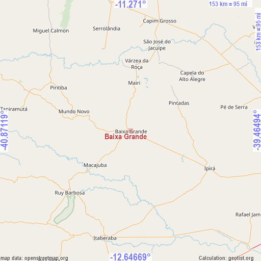
Baixa Grande GPS coordinates[2]
11° 57' 34.992" South, 40° 10' 5.016" West
| Map corner | latitude | longitude |
|---|---|---|
| Upper-left | -11.271°, | -40.87119° |
| Center: | -11.95972°, | -40.16806° |
| Lower-right: | -12.64669°, | -39.46494° |
| Map W x H: | 153×153 km | = 95.1×95.1mi |
| max Lat: | 2.81972° ⇑37.6% North |
| Baixa Grande: | -11.95972° |
| min Lat: | ⇓62.4% South -33.69111° |
| min Long | Baixa Grande | max Long |
| -72.89583° | -40.16806° | -32.41083° |
| W 74.6%⇐ | ⇒25.4% E |
Elevation
Elevation of Baixa Grande is 367 m = 1204 ft, and this is 13.9 m = 46 ft below average elevation for this country.
| Max E: |
1603 m = 5259 ft | 48.7% |
| Avg. | 380.9 m = 1250 ft | |
| Baixa Grande | 367 m = 1204 ft | |
Min E: |
0 m = 0 ft | 51.3% |
See also: Brazil elevation on elevation.city.
Geographical zone
Baixa Grande is located in South Torrid zone (between Equator and Tropic of Capricorn). Distance of this Southern Tropic circle is 1276.1 km =792.9 mi to South.| Distance of | km | miles | from Baixa Grande |
|---|---|---|---|
| Equator | 1329.8 | 826.3 | to North |
| Tropic Capricorn | 1276.1 | 792.9 | to South |
| Antarctic Circle | 6071.4 | 3772.6 | to South |
| South Pole | 8677.3 | 5391.8 | to South |


Nearby cities:
15 places around Baixa Grande: (largest is in red/bold)
• Anguera
102.5 km =63.7 mi,  101°
101°
• Capim Grosso
66.5 km =41.3 mi,  14°
14°
• Iaçu
89.9 km =55.9 mi,  183°
183°
• Ipirá
51.8 km =32.2 mi,  115°
115°
• Itaberaba
64.9 km =40.3 mi,  193°
193°
• Jacobina
94.4 km =58.7 mi,  336°
336°
• Mairi
27.7 km =17.2 mi,  4°
4°
• Miguel Calmon
75.1 km =46.7 mi,  321°
321°
• Mundo Novo
35 km =21.7 mi,  288°
288°
• Piritiba
49.3 km =30.6 mi,  301°
301°
• Riachão do Jacuípe
86.8 km =53.9 mi,  78°
78°
• Ruy Barbosa
50.5 km =31.4 mi,  224°
224°
• Tapiramutá
69 km =42.9 mi,  280°
280°
• Terra Nova
70.6 km =43.9 mi,  230°
230°
• Valente
98.1 km =61 mi,  51°
51°
Sources, notices
• [Note1] Compared only with cities in Brazil existing in our database
• [Src1] Map data: © OpenStreetMap contributors (CC-BY-SA)
• [Src2] Other city data from geonames.org with taken over terms of usage.
• [Src3] Geographical zone / Annual Mean Temperature by Robert A. Rohde @ Wikipedia
