Piuí geodata
Piuí (Minas Gerais) is a populated place; located in Brazil in America/Sao_Paulo (GMT-3) time zone. With population of 27,327 people, there are 724 cities with bigger population in this country. Compared to other cities in Brazil, 60% of cities are located further ↑North; 52.2% of cities are located further →East and 88.5% of cities have lower elevation than Piuí. Note1


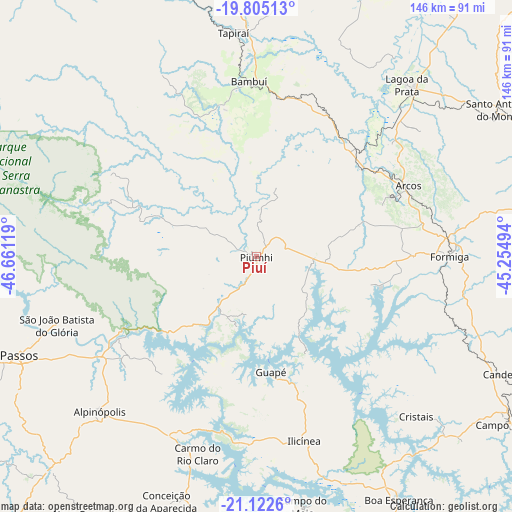
Piuí GPS coordinates[2]
20° 27' 55.008" South, 45° 57' 29.016" West
| Map corner | latitude | longitude |
|---|---|---|
| Upper-left | -19.80513°, | -46.66119° |
| Center: | -20.46528°, | -45.95806° |
| Lower-right: | -21.1226°, | -45.25494° |
| Map W x H: | 146.5×146.5 km | = 91×91mi |
| max Lat: | 2.81972° ⇑60% North |
| Piuí: | -20.46528° |
| min Lat: | ⇓40% South -33.69111° |
| min Long | Piuí | max Long |
| -72.89583° | -45.95806° | -32.41083° |
| W 47.8%⇐ | ⇒52.2% E |
Elevation
Elevation of Piuí is 791 m = 2595 ft, and this is 410.1 m = 1345 ft above average elevation for this country.
| Max E: |
1603 m = 5259 ft | 11.5% |
| Piuí | 791 m 2595 ft | |
| Avg. | 380.9 m = 1250 ft | |
Min E: |
0 m = 0 ft | 88.5% |
See also: Brazil elevation on elevation.city.
Geographical zone
Piuí is located in South Torrid zone (between Equator and Tropic of Capricorn). Distance of this Southern Tropic circle is 330.4 km =205.3 mi to South.| Distance of | km | miles | from Piuí |
|---|---|---|---|
| Equator | 2275.5 | 1413.9 | to North |
| Tropic Capricorn | 330.4 | 205.3 | to South |
| Antarctic Circle | 5125.6 | 3184.9 | to South |
| South Pole | 7731.5 | 4804.1 | to South |


Nearby cities:
15 places around Piuí: (largest is in red/bold)
• Alpinópolis
63 km =39.1 mi,  225°
225°
• Arcos
48.2 km =30 mi,  64°
64°
• Bambuí
51.1 km =31.8 mi,  357°
357°
• Boa Esperança
80.5 km =50 mi,  149°
149°
• Campo Belo
85.6 km =53.2 mi,  124°
124°
• Campos Gerais
88.1 km =54.7 mi,  166°
166°
• Capitólio
19.2 km =11.9 mi,  209°
209°
• Carmo do Rio Claro
58.8 km =36.5 mi,  196°
196°
• Formiga
55.4 km =34.4 mi,  89°
89°
• Itapecerica
86.7 km =53.9 mi, 90°
• Itaú de Minas
88.1 km =54.7 mi,  249°
249°
• Lagoa da Prata
65.5 km =40.7 mi,  41°
41°
• Luz
79.1 km =49.2 mi,  21°
21°
• Passos
73.5 km =45.7 mi, 247°
• Santo Antônio do Monte
81.1 km =50.4 mi, 58°
Sources, notices
• [Note1] Compared only with cities in Brazil existing in our database
• [Src1] Map data: © OpenStreetMap contributors (CC-BY-SA)
• [Src2] Other city data from geonames.org with taken over terms of usage.
• [Src3] Geographical zone / Annual Mean Temperature by Robert A. Rohde @ Wikipedia
