Passos geodata
Passos (Minas Gerais) is a populated place; located in Brazil in America/Sao_Paulo (GMT-3) time zone. With population of 98,752 people, there are 236 cities with bigger population in this country. Compared to other cities in Brazil, 61.2% of cities are located further ↑North; 55.6% of cities are located further →East and 84.3% of cities have lower elevation than Passos. Note1


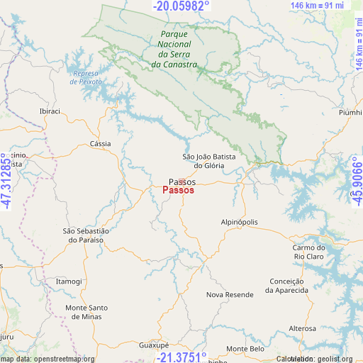
Passos GPS coordinates[2]
20° 43' 8.004" South, 46° 36' 34.992" West
| Map corner | latitude | longitude |
|---|---|---|
| Upper-left | -20.05982°, | -47.31285° |
| Center: | -20.71889°, | -46.60972° |
| Lower-right: | -21.3751°, | -45.9066° |
| Map W x H: | 146.2×146.2 km | = 90.8×90.8mi |
| max Lat: | 2.81972° ⇑61.2% North |
| Passos: | -20.71889° |
| min Lat: | ⇓38.8% South -33.69111° |
| min Long | Passos | max Long |
| -72.89583° | -46.60972° | -32.41083° |
| W 44.4%⇐ | ⇒55.6% E |
Elevation
Elevation of Passos is 751 m = 2464 ft, and this is 370.1 m = 1214 ft above average elevation for this country.
| Max E: |
1603 m = 5259 ft | 15.7% |
| Passos | 751 m 2464 ft | |
| Avg. | 380.9 m = 1250 ft | |
Min E: |
0 m = 0 ft | 84.3% |
See also: Passos elevation on elevation.city.
Geographical zone
Passos is located in South Torrid zone (between Equator and Tropic of Capricorn). Distance of this Southern Tropic circle is 302.2 km =187.8 mi to South.| Distance of | km | miles | from Passos |
|---|---|---|---|
| Equator | 2303.7 | 1431.5 | to North |
| Tropic Capricorn | 302.2 | 187.8 | to South |
| Antarctic Circle | 5097.4 | 3167.4 | to South |
| South Pole | 7703.3 | 4786.6 | to South |


Nearby cities:
15 places around Passos: (largest is in red/bold)
• Alpinópolis
28.1 km =17.5 mi,  124°
124°
• Alterosa
76.3 km =47.4 mi,  140°
140°
• Altinópolis
86.4 km =53.7 mi,  246°
246°
• Areado
85.9 km =53.4 mi,  145°
145°
• Capitólio
59.4 km =36.9 mi,  78°
78°
• Carmo do Rio Claro
58.2 km =36.2 mi, 118°
• Cássia
35.8 km =22.2 mi,  294°
294°
• Franca
84.7 km =52.6 mi,  283°
283°
• Guaranésia
67.6 km =42 mi,  197°
197°
• Guaxupé
66.1 km =41.1 mi,  189°
189°
• Itaú de Minas
15 km =9.3 mi,  261°
261°
• Monte Santo de Minas
65 km =40.4 mi,  216°
216°
• Muzambinho
73.6 km =45.7 mi,  173°
173°
• Piuí
73.5 km =45.7 mi,  67°
67°
• São Sebastião do Paraíso
45.4 km =28.2 mi,  240°
240°
Sources, notices
• [Note1] Compared only with cities in Brazil existing in our database
• [Src1] Map data: © OpenStreetMap contributors (CC-BY-SA)
• [Src2] Other city data from geonames.org with taken over terms of usage.
• [Src3] Geographical zone / Annual Mean Temperature by Robert A. Rohde @ Wikipedia
