Matias Barbosa geodata
Matias Barbosa (Minas Gerais) is a populated place; located in Brazil in America/Sao_Paulo (GMT-3) time zone. With population of 12,072 people, there are 1471 cities with bigger population in this country. Compared to other cities in Brazil, 69.2% of cities are located further ↑North; 58.9% of cities are located further ←West and 60.7% of cities have lower elevation than Matias Barbosa. Note1


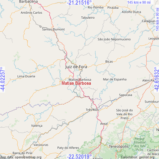
Matias Barbosa GPS coordinates[2]
21° 52' 9.012" South, 43° 19' 9.984" West
| Map corner | latitude | longitude |
|---|---|---|
| Upper-left | -21.21516°, | -44.02257° |
| Center: | -21.86917°, | -43.31944° |
| Lower-right: | -22.52019°, | -42.61632° |
| Map W x H: | 145.1×145.1 km | = 90.2×90.2mi |
| max Lat: | 2.81972° ⇑69.2% North |
| Matias Barbosa: | -21.86917° |
| min Lat: | ⇓30.8% South -33.69111° |
| min Long | Matias Barbosa | max Long |
| -72.89583° | -43.31944° | -32.41083° |
| W 58.9%⇐ | ⇒41.1% E |
Elevation
Elevation of Matias Barbosa is 481 m = 1578 ft, and this is 100.1 m = 328 ft above average elevation for this country.
| Max E: |
1603 m = 5259 ft | 39.3% |
| Matias Barbosa | 481 m 1578 ft | |
| Avg. | 380.9 m = 1250 ft | |
Min E: |
0 m = 0 ft | 60.7% |
See also: Brazil elevation on elevation.city.
Geographical zone
Matias Barbosa is located in South Torrid zone (between Equator and Tropic of Capricorn). Distance of this Southern Tropic circle is 174.3 km =108.3 mi to South.| Distance of | km | miles | from Matias Barbosa |
|---|---|---|---|
| Equator | 2431.6 | 1510.9 | to North |
| Tropic Capricorn | 174.3 | 108.3 | to South |
| Antarctic Circle | 4969.6 | 3088 | to South |
| South Pole | 7575.4 | 4707.1 | to South |


Nearby cities:
15 places around Matias Barbosa: (largest is in red/bold)
• Além Paraíba
63.5 km =39.5 mi,  91°
91°
• Areal
45.8 km =28.5 mi,  151°
151°
• Bicas
31.2 km =19.4 mi,  59°
59°
• Juiz de Fora
12.1 km =7.5 mi,  344°
344°
• Lima Duarte
49 km =30.4 mi,  273°
273°
• Mar de Espanha
32 km =19.9 mi, 89°
• Miguel Pereira
66.8 km =41.5 mi,  193°
193°
• Paraíba do Sul
32.3 km =20.1 mi,  175°
175°
• Paty do Alferes
63 km =39.1 mi, 189°
• Rio Novo
48 km =29.8 mi,  24°
24°
• Santos Dumont
51.8 km =32.2 mi,  332°
332°
• Sapucaia
44.1 km =27.4 mi,  108°
108°
• São João Nepomuceno
48.6 km =30.2 mi,  41°
41°
• Três Rios
29.8 km =18.5 mi,  157°
157°
• Valença
57.4 km =35.7 mi,  223°
223°
Sources, notices
• [Note1] Compared only with cities in Brazil existing in our database
• [Src1] Map data: © OpenStreetMap contributors (CC-BY-SA)
• [Src2] Other city data from geonames.org with taken over terms of usage.
• [Src3] Geographical zone / Annual Mean Temperature by Robert A. Rohde @ Wikipedia
