Laranjeiras do Sul geodata
Laranjeiras do Sul (Paraná) is a populated place; located in Brazil in America/Sao_Paulo (GMT-3) time zone. With population of 18,424 people, there are 1014 cities with bigger population in this country. Compared to other cities in Brazil, 88.5% of cities are located further ↑North; 89% of cities are located further →East and 92.2% of cities have lower elevation than Laranjeiras do Sul. Note1


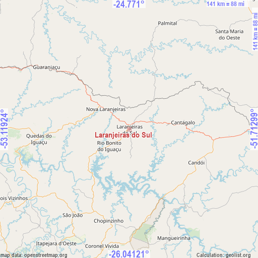
Laranjeiras do Sul GPS coordinates[2]
25° 24' 28.008" South, 52° 24' 57.996" West
| Map corner | latitude | longitude |
|---|---|---|
| Upper-left | -24.771°, | -53.11924° |
| Center: | -25.40778°, | -52.41611° |
| Lower-right: | -26.04121°, | -51.71299° |
| Map W x H: | 141.2×141.2 km | = 87.7×87.7mi |
| max Lat: | 2.81972° ⇑88.5% North |
| Laranjeiras do Sul: | -25.40778° |
| min Lat: | ⇓11.5% South -33.69111° |
| min Long | Laranjeiras do | max Long |
| -72.89583° | -52.41611° | -32.41083° |
| W 11%⇐ | ⇒89% E |
Elevation
Elevation of Laranjeiras do Sul is 846 m = 2776 ft, and this is 465.1 m = 1526 ft above average elevation for this country.
| Max E: |
1603 m = 5259 ft | 7.8% |
| Laranjeiras do Sul | 846 m 2776 ft | |
| Avg. | 380.9 m = 1250 ft | |
Min E: |
0 m = 0 ft | 92.2% |
See also: Brazil elevation on elevation.city.
Geographical zone
Laranjeiras do Sul is located in South temperate zone (between Tropic of Capricorn and the Antarctic Circle). Distance of this Southern Tropic circle is 219.2 km =136.2 mi to North.| Distance of | km | miles | from Laranjeiras do Sul |
|---|---|---|---|
| Equator | 2825.1 | 1755.4 | to North |
| Tropic Capricorn | 219.2 | 136.2 | to North |
| Antarctic Circle | 4576.1 | 2843.5 | to South |
| South Pole | 7182 | 4462.7 | to South |


Nearby cities:
15 places around Laranjeiras do Sul: (largest is in red/bold)
• Ampére
120 km =74.6 mi,  241°
241°
• Cascavel
116 km =72.1 mi,  295°
295°
• Chopinzinho
51 km =31.7 mi,  192°
192°
• Clevelândia
110 km =68.4 mi,  182°
182°
• Corbélia
112.4 km =69.8 mi,  307°
307°
• Coronel Vivida
65.4 km =40.6 mi, 193°
• Dois Vizinhos
73.8 km =45.9 mi, 240°
• Francisco Beltrão
98.5 km =61.2 mi,  220°
220°
• Guaraniaçu
57.6 km =35.8 mi, 306°
• Guarapuava
95.5 km =59.3 mi,  88°
88°
• Pato Branco
94.8 km =58.9 mi,  195°
195°
• Pinhão
82.3 km =51.1 mi,  112°
112°
• Pitanga
97.9 km =60.8 mi,  42°
42°
• Realeza
118.9 km =73.9 mi,  250°
250°
• São Lourenço do Oeste
114.4 km =71.1 mi, 202°
Sources, notices
• [Note1] Compared only with cities in Brazil existing in our database
• [Src1] Map data: © OpenStreetMap contributors (CC-BY-SA)
• [Src2] Other city data from geonames.org with taken over terms of usage.
• [Src3] Geographical zone / Annual Mean Temperature by Robert A. Rohde @ Wikipedia
