Pitanga geodata
Pitanga (Paraná) is a populated place; located in Brazil in America/Sao_Paulo (GMT-3) time zone. With population of 18,652 people, there are 1001 cities with bigger population in this country. Compared to other cities in Brazil, 87.5% of cities are located further ↑North; 86.7% of cities are located further →East and 94.7% of cities have lower elevation than Pitanga. Note1


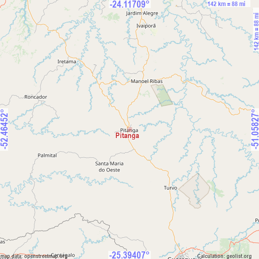
Pitanga GPS coordinates[2]
24° 45' 25.992" South, 51° 45' 41.004" West
| Map corner | latitude | longitude |
|---|---|---|
| Upper-left | -24.11709°, | -52.46452° |
| Center: | -24.75722°, | -51.76139° |
| Lower-right: | -25.39407°, | -51.05827° |
| Map W x H: | 142×142 km | = 88.2×88.2mi |
| max Lat: | 2.81972° ⇑87.5% North |
| Pitanga: | -24.75722° |
| min Lat: | ⇓12.5% South -33.69111° |
| min Long | Pitanga | max Long |
| -72.89583° | -51.76139° | -32.41083° |
| W 13.3%⇐ | ⇒86.7% E |
Elevation
Elevation of Pitanga is 889 m = 2917 ft, and this is 508.1 m = 1667 ft above average elevation for this country.
| Max E: |
1603 m = 5259 ft | 5.3% |
| Pitanga | 889 m 2917 ft | |
| Avg. | 380.9 m = 1250 ft | |
Min E: |
0 m = 0 ft | 94.7% |
See also: Brazil elevation on elevation.city.
Geographical zone
Pitanga is located in South temperate zone (between Tropic of Capricorn and the Antarctic Circle). Distance of this Southern Tropic circle is 146.8 km =91.2 mi to North.| Distance of | km | miles | from Pitanga |
|---|---|---|---|
| Equator | 2752.7 | 1710.4 | to North |
| Tropic Capricorn | 146.8 | 91.2 | to North |
| Antarctic Circle | 4648.4 | 2888.4 | to South |
| South Pole | 7254.3 | 4507.6 | to South |


Nearby cities:
15 places around Pitanga: (largest is in red/bold)
• Campo Mourão
101.1 km =62.8 mi,  321°
321°
• Cândido de Abreu
48.2 km =30 mi,  63°
63°
• Engenheiro Beltrão
118.5 km =73.6 mi,  334°
334°
• Faxinal
95.3 km =59.2 mi,  28°
28°
• Guaraniaçu
118.9 km =73.9 mi,  251°
251°
• Guarapuava
76.5 km =47.5 mi,  157°
157°
• Imbituva
127.9 km =79.5 mi,  114°
114°
• Jandaia do Sul
128.9 km =80.1 mi,  5°
5°
• Laranjeiras do Sul
97.9 km =60.8 mi,  222°
222°
• Ortigueira
102.3 km =63.6 mi,  53°
53°
• Peabiru
110.9 km =68.9 mi, 327°
• Pinhão
104.8 km =65.1 mi,  174°
174°
• Prudentópolis
93.8 km =58.3 mi,  122°
122°
• Reserva
92.8 km =57.7 mi,  82°
82°
• Telêmaco Borba
125.5 km =78 mi,  67°
67°
Sources, notices
• [Note1] Compared only with cities in Brazil existing in our database
• [Src1] Map data: © OpenStreetMap contributors (CC-BY-SA)
• [Src2] Other city data from geonames.org with taken over terms of usage.
• [Src3] Geographical zone / Annual Mean Temperature by Robert A. Rohde @ Wikipedia
