Guarapuava geodata
Guarapuava (Paraná) is a populated place; located in Brazil in America/Sao_Paulo (GMT-3) time zone. With population of 150,850 people, there are 153 cities with bigger population in this country. Compared to other cities in Brazil, 88.5% of cities are located further ↑North; 85.3% of cities are located further →East and 99.4% of cities have lower elevation than Guarapuava. Note1


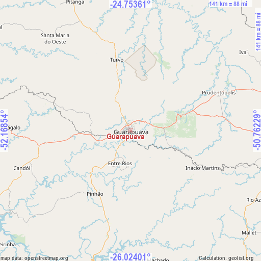
Guarapuava GPS coordinates[2]
25° 23' 25.728" South, 51° 27' 55.476" West
| Map corner | latitude | longitude |
|---|---|---|
| Upper-left | -24.75361°, | -52.16854° |
| Center: | -25.39048°, | -51.46541° |
| Lower-right: | -26.02401°, | -50.76229° |
| Map W x H: | 141.3×141.3 km | = 87.8×87.8mi |
| max Lat: | 2.81972° ⇑88.5% North |
| Guarapuava: | -25.39048° |
| min Lat: | ⇓11.5% South -33.69111° |
| min Long | Guarapuava | max Long |
| -72.89583° | -51.46541° | -32.41083° |
| W 14.7%⇐ | ⇒85.3% E |
Elevation
Elevation of Guarapuava is 1090 m = 3576 ft, and this is 709.1 m = 2326 ft above average elevation for this country.
| Max E: |
1603 m = 5259 ft | 0.59999999999999% |
| Guarapuava | 1090 m 3576 ft | |
| Avg. | 380.9 m = 1250 ft | |
Min E: |
0 m = 0 ft | 99.4% |
See also: Guarapuava elevation on elevation.city.
Geographical zone
Guarapuava is located in South temperate zone (between Tropic of Capricorn and the Antarctic Circle). Distance of this Southern Tropic circle is 217.2 km =135 mi to North.| Distance of | km | miles | from Guarapuava |
|---|---|---|---|
| Equator | 2823.2 | 1754.3 | to North |
| Tropic Capricorn | 217.2 | 135 | to North |
| Antarctic Circle | 4578 | 2844.6 | to South |
| South Pole | 7183.9 | 4463.9 | to South |


Nearby cities:
15 places around Guarapuava: (largest is in red/bold)
• Chopinzinho
118 km =73.3 mi,  243°
243°
• Coronel Vivida
128.4 km =79.8 mi, 239°
• Cândido de Abreu
92.5 km =57.5 mi,  8°
8°
• Imbituva
88.4 km =54.9 mi,  78°
78°
• Irati
82.2 km =51.1 mi,  95°
95°
• Laranjeiras do Sul
95.5 km =59.3 mi,  268°
268°
• Palmas
132.5 km =82.3 mi,  203°
203°
• Pinhão
39.1 km =24.3 mi,  209°
209°
• Pitanga
76.5 km =47.5 mi,  337°
337°
• Ponta Grossa
135.1 km =83.9 mi, 75°
• Porto União
101.9 km =63.3 mi,  157°
157°
• Prudentópolis
52.8 km =32.8 mi,  68°
68°
• Reserva
103 km =64 mi,  36°
36°
• São Mateus do Sul
121.1 km =75.2 mi,  116°
116°
• União da Vitória
100.8 km =62.6 mi, 157°
Sources, notices
• [Note1] Compared only with cities in Brazil existing in our database
• [Src1] Map data: © OpenStreetMap contributors (CC-BY-SA)
• [Src2] Other city data from geonames.org with taken over terms of usage.
• [Src3] Geographical zone / Annual Mean Temperature by Robert A. Rohde @ Wikipedia
