Igarapava geodata
Igarapava (São Paulo) is a populated place; located in Brazil in America/Sao_Paulo (GMT-3) time zone. With population of 29,057 people, there are 685 cities with bigger population in this country. Compared to other cities in Brazil, 57.4% of cities are located further ↑North; 63.3% of cities are located further →East and 69.7% of cities have lower elevation than Igarapava. Note1


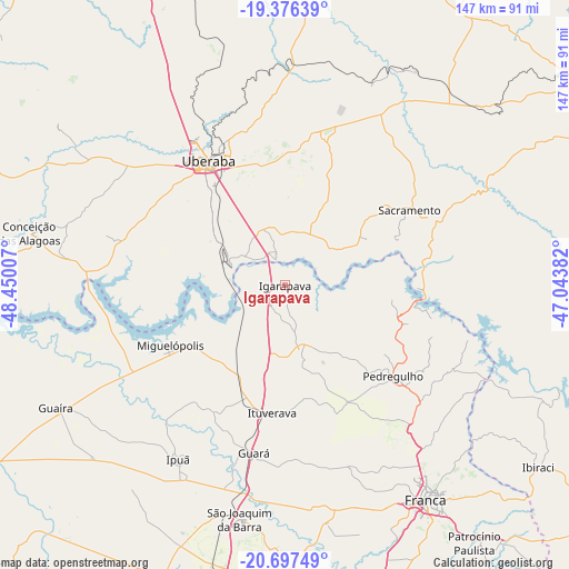
Igarapava GPS coordinates[2]
20° 2' 17.988" South, 47° 44' 48.984" West
| Map corner | latitude | longitude |
|---|---|---|
| Upper-left | -19.37639°, | -48.45007° |
| Center: | -20.03833°, | -47.74694° |
| Lower-right: | -20.69749°, | -47.04382° |
| Map W x H: | 146.9×146.9 km | = 91.3×91.3mi |
| max Lat: | 2.81972° ⇑57.4% North |
| Igarapava: | -20.03833° |
| min Lat: | ⇓42.6% South -33.69111° |
| min Long | Igarapava | max Long |
| -72.89583° | -47.74694° | -32.41083° |
| W 36.7%⇐ | ⇒63.3% E |
Elevation
Elevation of Igarapava is 572 m = 1877 ft, and this is 191.1 m = 627 ft above average elevation for this country.
| Max E: |
1603 m = 5259 ft | 30.3% |
| Igarapava | 572 m 1877 ft | |
| Avg. | 380.9 m = 1250 ft | |
Min E: |
0 m = 0 ft | 69.7% |
See also: Brazil elevation on elevation.city.
Geographical zone
Igarapava is located in South Torrid zone (between Equator and Tropic of Capricorn). Distance of this Southern Tropic circle is 377.9 km =234.8 mi to South.| Distance of | km | miles | from Igarapava |
|---|---|---|---|
| Equator | 2228.1 | 1384.5 | to North |
| Tropic Capricorn | 377.9 | 234.8 | to South |
| Antarctic Circle | 5173.1 | 3214.4 | to South |
| South Pole | 7779 | 4833.6 | to South |


Nearby cities:
15 places around Igarapava: (largest is in red/bold)
• Batatais
96.3 km =59.8 mi,  169°
169°
• Conceição das Alagoas
68.4 km =42.5 mi,  281°
281°
• Franca
66.3 km =41.2 mi,  147°
147°
• Guará
44.1 km =27.4 mi,  190°
190°
• Guaíra
66.6 km =41.4 mi,  242°
242°
• Ipuã
52.4 km =32.6 mi,  211°
211°
• Ituverava
33.7 km =20.9 mi, 185°
• Miguelópolis
33.6 km =20.9 mi, 242°
• Morro Agudo
83.6 km =51.9 mi,  202°
202°
• Nuporanga
77 km =47.8 mi,  180°
180°
• Orlândia
77.2 km =48 mi, 190°
• Pedregulho
37.2 km =23.1 mi,  130°
130°
• Sacramento
37.4 km =23.2 mi,  59°
59°
• São Joaquim da Barra
61.4 km =38.2 mi, 190°
• Uberaba
37.6 km =23.4 mi,  329°
329°
Sources, notices
• [Note1] Compared only with cities in Brazil existing in our database
• [Src1] Map data: © OpenStreetMap contributors (CC-BY-SA)
• [Src2] Other city data from geonames.org with taken over terms of usage.
• [Src3] Geographical zone / Annual Mean Temperature by Robert A. Rohde @ Wikipedia
