Sacramento geodata
Sacramento (Minas Gerais) is a populated place; located in Brazil in America/Sao_Paulo (GMT-3) time zone. With population of 16,982 people, there are 1095 cities with bigger population in this country. Compared to other cities in Brazil, 56.3% of cities are located further ↑North; 61.2% of cities are located further →East and 91.8% of cities have lower elevation than Sacramento. Note1


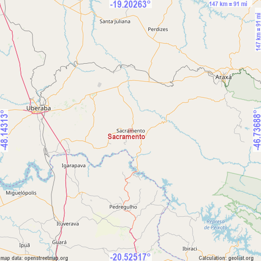
Sacramento GPS coordinates[2]
19° 51' 55.008" South, 47° 26' 24" West
| Map corner | latitude | longitude |
|---|---|---|
| Upper-left | -19.20263°, | -48.14313° |
| Center: | -19.86528°, | -47.44° |
| Lower-right: | -20.52517°, | -46.73688° |
| Map W x H: | 147.1×147.1 km | = 91.4×91.4mi |
| max Lat: | 2.81972° ⇑56.3% North |
| Sacramento: | -19.86528° |
| min Lat: | ⇓43.7% South -33.69111° |
| min Long | Sacramento | max Long |
| -72.89583° | -47.44° | -32.41083° |
| W 38.8%⇐ | ⇒61.2% E |
Elevation
Elevation of Sacramento is 841 m = 2759 ft, and this is 460.1 m = 1510 ft above average elevation for this country.
| Max E: |
1603 m = 5259 ft | 8.2% |
| Sacramento | 841 m 2759 ft | |
| Avg. | 380.9 m = 1250 ft | |
Min E: |
0 m = 0 ft | 91.8% |
See also: Brazil elevation on elevation.city.
Geographical zone
Sacramento is located in South Torrid zone (between Equator and Tropic of Capricorn). Distance of this Southern Tropic circle is 397.1 km =246.7 mi to South.| Distance of | km | miles | from Sacramento |
|---|---|---|---|
| Equator | 2208.8 | 1372.5 | to North |
| Tropic Capricorn | 397.1 | 246.7 | to South |
| Antarctic Circle | 5192.4 | 3226.4 | to South |
| South Pole | 7798.2 | 4845.6 | to South |


Nearby cities:
15 places around Sacramento: (largest is in red/bold)
• Araxá
60.4 km =37.5 mi,  59°
59°
• Conceição das Alagoas
99.3 km =61.7 mi,  266°
266°
• Cássia
96.4 km =59.9 mi,  145°
145°
• Franca
75 km =46.6 mi,  176°
176°
• Guará
74.3 km =46.2 mi,  212°
212°
• Guaíra
103.9 km =64.6 mi,  241°
241°
• Ibiá
103.7 km =64.4 mi,  65°
65°
• Igarapava
37.4 km =23.2 mi, 239°
• Ipuã
87.3 km =54.2 mi,  223°
223°
• Ituverava
63.6 km =39.5 mi, 213°
• Miguelópolis
71 km =44.1 mi, 240°
• Nuporanga
101.6 km =63.1 mi,  198°
198°
• Pedregulho
43.7 km =27.2 mi,  185°
185°
• São Joaquim da Barra
90.6 km =56.3 mi, 208°
• Uberaba
53.1 km =33 mi,  284°
284°
Sources, notices
• [Note1] Compared only with cities in Brazil existing in our database
• [Src1] Map data: © OpenStreetMap contributors (CC-BY-SA)
• [Src2] Other city data from geonames.org with taken over terms of usage.
• [Src3] Geographical zone / Annual Mean Temperature by Robert A. Rohde @ Wikipedia
