Camapuã geodata
Camapuã (Mato Grosso do Sul) is a populated place; located in Brazil in America/Campo_Grande (GMT-4) time zone. With population of 11,118 people, there are 1557 cities with bigger population in this country. Compared to other cities in Brazil, 54.7% of cities are located further ↑North; 92.5% of cities are located further →East and 54.2% of cities have lower elevation than Camapuã. Note1


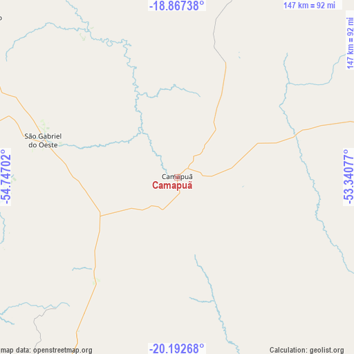
Camapuã GPS coordinates[2]
19° 31' 53.004" South, 54° 2' 38.004" West
| Map corner | latitude | longitude |
|---|---|---|
| Upper-left | -18.86738°, | -54.74702° |
| Center: | -19.53139°, | -54.04389° |
| Lower-right: | -20.19268°, | -53.34077° |
| Map W x H: | 147.4×147.4 km | = 91.6×91.6mi |
| max Lat: | 2.81972° ⇑54.7% North |
| Camapuã: | -19.53139° |
| min Lat: | ⇓45.3% South -33.69111° |
| min Long | Camapuã | max Long |
| -72.89583° | -54.04389° | -32.41083° |
| W 7.5%⇐ | ⇒92.5% E |
Elevation
Elevation of Camapuã is 410 m = 1345 ft, and this is 29.1 m = 95 ft above average elevation for this country.
| Max E: |
1603 m = 5259 ft | 45.8% |
| Camapuã | 410 m 1345 ft | |
| Avg. | 380.9 m = 1250 ft | |
Min E: |
0 m = 0 ft | 54.2% |
See also: Brazil elevation on elevation.city.
Geographical zone
Camapuã is located in South Torrid zone (between Equator and Tropic of Capricorn). Distance of this Southern Tropic circle is 434.2 km =269.8 mi to South.| Distance of | km | miles | from Camapuã |
|---|---|---|---|
| Equator | 2171.7 | 1349.4 | to North |
| Tropic Capricorn | 434.2 | 269.8 | to South |
| Antarctic Circle | 5229.5 | 3249.5 | to South |
| South Pole | 7835.4 | 4868.7 | to South |


Nearby cities:
15 places around Camapuã: (largest is in red/bold)
• Alto Araguaia
261.5 km =162.5 mi,  19°
19°
• Anastácio
212.5 km =132 mi,  240°
240°
• Aquidauana
210 km =130.5 mi, 240°
• Campo Grande
119.3 km =74.1 mi,  211°
211°
• Campo Verde
98.5 km =61.2 mi,  181°
181°
• Cassilândia
246.8 km =153.4 mi,  79°
79°
• Coxim
136.6 km =84.9 mi,  326°
326°
• Maracaju
259.5 km =161.2 mi, 206°
• Miranda
256.5 km =159.4 mi,  252°
252°
• Paraíso das Águas
122.4 km =76.1 mi,  62°
62°
• Ribas do Rio Pardo
105.6 km =65.6 mi,  163°
163°
• Rio Brilhante
257.8 km =160.2 mi,  191°
191°
• Rio Verde de Mato Grosso
108.2 km =67.2 mi,  309°
309°
• Sidrolândia
182.8 km =113.6 mi, 211°
• Terenos
132.4 km =82.3 mi,  220°
220°
Sources, notices
• [Note1] Compared only with cities in Brazil existing in our database
• [Src1] Map data: © OpenStreetMap contributors (CC-BY-SA)
• [Src2] Other city data from geonames.org with taken over terms of usage.
• [Src3] Geographical zone / Annual Mean Temperature by Robert A. Rohde @ Wikipedia
