Paraíso das Águas geodata
Paraíso das Águas (Mato Grosso do Sul) is a populated place; located in Brazil in America/Campo_Grande (GMT-4) time zone. With population of 4,273 people, there are 1953 cities with bigger population in this country. Compared to other cities in Brazil, 53.4% of cities are located further ↑North; 90.5% of cities are located further →East and 72.2% of cities have lower elevation than Paraíso das Águas. Note1


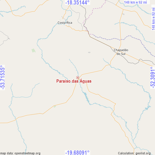
Paraíso das Águas GPS coordinates[2]
19° 1' 3" South, 53° 0' 43.992" West
| Map corner | latitude | longitude |
|---|---|---|
| Upper-left | -18.35144°, | -53.71535° |
| Center: | -19.0175°, | -53.01222° |
| Lower-right: | -19.68091°, | -52.3091° |
| Map W x H: | 147.8×147.8 km | = 91.8×91.8mi |
| max Lat: | 2.81972° ⇑53.4% North |
| Paraíso das Águas: | -19.0175° |
| min Lat: | ⇓46.6% South -33.69111° |
| min Long | Paraíso das Á | max Long |
| -72.89583° | -53.01222° | -32.41083° |
| W 9.5%⇐ | ⇒90.5% E |
Elevation
Elevation of Paraíso das Águas is 594 m = 1949 ft, and this is 213.1 m = 699 ft above average elevation for this country.
| Max E: |
1603 m = 5259 ft | 27.8% |
| Paraíso das Águas | 594 m 1949 ft | |
| Avg. | 380.9 m = 1250 ft | |
Min E: |
0 m = 0 ft | 72.2% |
See also: Brazil elevation on elevation.city.
Geographical zone
Paraíso das Águas is located in South Torrid zone (between Equator and Tropic of Capricorn). Distance of this Southern Tropic circle is 491.4 km =305.3 mi to South.| Distance of | km | miles | from Paraíso das Águas |
|---|---|---|---|
| Equator | 2114.5 | 1313.9 | to North |
| Tropic Capricorn | 491.4 | 305.3 | to South |
| Antarctic Circle | 5286.6 | 3284.9 | to South |
| South Pole | 7892.5 | 4904.2 | to South |


Nearby cities:
15 places around Paraíso das Águas: (largest is in red/bold)
• Alto Araguaia
190.5 km =118.4 mi,  353°
353°
• Aparecida do Taboado
233.5 km =145.1 mi,  120°
120°
• Camapuã
122.4 km =76.1 mi,  242°
242°
• Campo Grande
233.2 km =144.9 mi,  227°
227°
• Campo Verde
190.7 km =118.5 mi,  215°
215°
• Cassilândia
134.7 km =83.7 mi,  94°
94°
• Caçu
204.6 km =127.1 mi,  75°
75°
• Coxim
192.6 km =119.7 mi,  287°
287°
• Ilha Solteira
235.2 km =146.1 mi,  132°
132°
• Jataí
185.9 km =115.5 mi,  47°
47°
• Mineiros
168.2 km =104.5 mi,  16°
16°
• Paranaíba
204.7 km =127.2 mi,  111°
111°
• Portelândia
188.3 km =117 mi,  10°
10°
• Ribas do Rio Pardo
176.7 km =109.8 mi,  206°
206°
• Rio Verde de Mato Grosso
192.9 km =119.9 mi,  273°
273°
Sources, notices
• [Note1] Compared only with cities in Brazil existing in our database
• [Src1] Map data: © OpenStreetMap contributors (CC-BY-SA)
• [Src2] Other city data from geonames.org with taken over terms of usage.
• [Src3] Geographical zone / Annual Mean Temperature by Robert A. Rohde @ Wikipedia
