Baixo Guandu geodata
Baixo Guandu (Espírito Santo) is a populated place; located in Brazil in America/Sao_Paulo (GMT-3) time zone. With population of 19,292 people, there are 971 cities with bigger population in this country. Compared to other cities in Brazil, 54.6% of cities are located further ↑North; 70% of cities are located further ←West and 74.9% of cities have higher elevation than Baixo Guandu. Note1


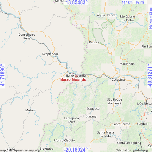
Baixo Guandu GPS coordinates[2]
19° 31' 8.004" South, 41° 0' 56.988" West
| Map corner | latitude | longitude |
|---|---|---|
| Upper-left | -18.85483°, | -41.71896° |
| Center: | -19.51889°, | -41.01583° |
| Lower-right: | -20.18024°, | -40.31271° |
| Map W x H: | 147.4×147.4 km | = 91.6×91.6mi |
| max Lat: | 2.81972° ⇑54.6% North |
| Baixo Guandu: | -19.51889° |
| min Lat: | ⇓45.4% South -33.69111° |
| min Long | Baixo Guandu | max Long |
| -72.89583° | -41.01583° | -32.41083° |
| W 70%⇐ | ⇒30% E |
Elevation
Elevation of Baixo Guandu is 78 m = 256 ft, and this is 302.9 m = 994 ft below average elevation for this country.
| Max E: |
1603 m = 5259 ft | 74.9% |
| Avg. | 380.9 m = 1250 ft | |
| Baixo Guandu | 78 m = 256 ft | |
Min E: |
0 m = 0 ft | 25.1% |
See also: Brazil elevation on elevation.city.
Geographical zone
Baixo Guandu is located in South Torrid zone (between Equator and Tropic of Capricorn). Distance of this Southern Tropic circle is 435.6 km =270.7 mi to South.| Distance of | km | miles | from Baixo Guandu |
|---|---|---|---|
| Equator | 2170.3 | 1348.6 | to North |
| Tropic Capricorn | 435.6 | 270.7 | to South |
| Antarctic Circle | 5230.9 | 3250.3 | to South |
| South Pole | 7836.8 | 4869.6 | to South |


Nearby cities:
15 places around Baixo Guandu: (largest is in red/bold)
• Afonso Cláudio
62.8 km =39 mi,  190°
190°
• Aimorés
5.7 km =3.5 mi,  296°
296°
• Colatina
40.4 km =25.1 mi,  93°
93°
• Conselheiro Pena
61.5 km =38.2 mi,  308°
308°
• Itaguaçu
35.7 km =22.2 mi,  151°
151°
• Itarana
42.1 km =26.2 mi,  159°
159°
• Jetibá
65.9 km =40.9 mi, 147°
• Laranja da Terra
42.5 km =26.4 mi, 185°
• Marilândia
51.1 km =31.8 mi,  76°
76°
• Mutum
54.2 km =33.7 mi,  234°
234°
• Pancas
37 km =23 mi,  27°
27°
• Resplendor
33.1 km =20.6 mi, 310°
• Santa Maria de Jetibá
63.3 km =39.3 mi, 153°
• Santa Teresa
63.5 km =39.5 mi,  136°
136°
• Águia Branca
66.2 km =41.1 mi, 25°
Sources, notices
• [Note1] Compared only with cities in Brazil existing in our database
• [Src1] Map data: © OpenStreetMap contributors (CC-BY-SA)
• [Src2] Other city data from geonames.org with taken over terms of usage.
• [Src3] Geographical zone / Annual Mean Temperature by Robert A. Rohde @ Wikipedia
