Alvorada geodata
Alvorada (Tocantins) is a populated place; located in Brazil in America/Araguaina (GMT-3) time zone. With population of 10,232 people, there are 1632 cities with bigger population in this country. Compared to other cities in Brazil, 61.3% of cities are located further ↓South; 72.4% of cities are located further →East and 53.1% of cities have higher elevation than Alvorada. Note1


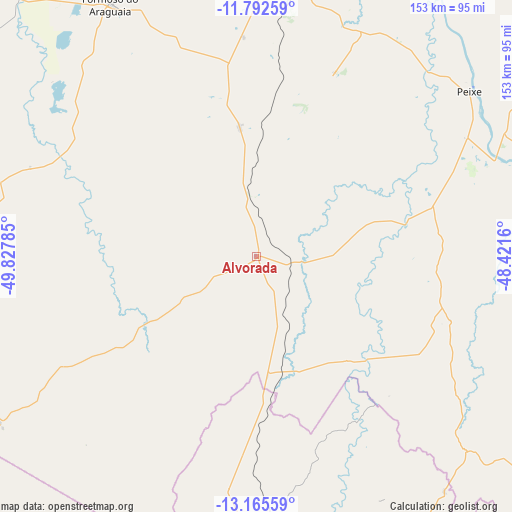
Alvorada GPS coordinates[2]
12° 28' 48" South, 49° 7' 28.992" West
| Map corner | latitude | longitude |
|---|---|---|
| Upper-left | -11.79259°, | -49.82785° |
| Center: | -12.48°, | -49.12472° |
| Lower-right: | -13.16559°, | -48.4216° |
| Map W x H: | 152.7×152.7 km | = 94.9×94.9mi |
| max Lat: | 2.81972° ⇑38.7% North |
| Alvorada: | -12.48° |
| min Lat: | ⇓61.3% South -33.69111° |
| min Long | Alvorada | max Long |
| -72.89583° | -49.12472° | -32.41083° |
| W 27.6%⇐ | ⇒72.4% E |
Elevation
Elevation of Alvorada is 298 m = 978 ft, and this is 82.9 m = 272 ft below average elevation for this country.
| Max E: |
1603 m = 5259 ft | 53.1% |
| Avg. | 380.9 m = 1250 ft | |
| Alvorada | 298 m = 978 ft | |
Min E: |
0 m = 0 ft | 46.9% |
See also: Brazil elevation on elevation.city.
Geographical zone
Alvorada is located in South Torrid zone (between Equator and Tropic of Capricorn). Distance of this Southern Tropic circle is 1218.3 km =757 mi to South.| Distance of | km | miles | from Alvorada |
|---|---|---|---|
| Equator | 1387.6 | 862.2 | to North |
| Tropic Capricorn | 1218.3 | 757 | to South |
| Antarctic Circle | 6013.5 | 3736.6 | to South |
| South Pole | 8619.4 | 5355.8 | to South |


Nearby cities:
15 places around Alvorada: (largest is in red/bold)
• Arraias
242.4 km =150.6 mi,  101°
101°
• Barro Alto
277.9 km =172.7 mi,  175°
175°
• Campos Belos
262.6 km =163.2 mi, 103°
• Cavalcante
232.4 km =144.4 mi,  129°
129°
• Crixás
247.5 km =153.8 mi,  201°
201°
• Gurupi
83.7 km =52 mi,  4°
4°
• Itapaci
278.5 km =173.1 mi,  189°
189°
• Minaçu
152.7 km =94.9 mi,  140°
140°
• Niquelândia
233.1 km =144.8 mi,  162°
162°
• Palmas
271.4 km =168.6 mi,  18°
18°
• Porangatu
106.9 km =66.4 mi, 181°
• Santa Terezinha
269.9 km =167.7 mi,  325°
325°
• São Miguel do Araguaia
143.1 km =88.9 mi,  231°
231°
• Taguatinga
292 km =181.4 mi,  88°
88°
• Uruaçu
227.4 km =141.3 mi, 180°
Sources, notices
• [Note1] Compared only with cities in Brazil existing in our database
• [Src1] Map data: © OpenStreetMap contributors (CC-BY-SA)
• [Src2] Other city data from geonames.org with taken over terms of usage.
• [Src3] Geographical zone / Annual Mean Temperature by Robert A. Rohde @ Wikipedia
