Niquelândia geodata
Niquelândia (Goiás) is a populated place; located in Brazil in America/Sao_Paulo (GMT-3) time zone. With population of 27,541 people, there are 719 cities with bigger population in this country. Compared to other cities in Brazil, 57.3% of cities are located further ↓South; 66.7% of cities are located further →East and 70.6% of cities have lower elevation than Niquelândia. Note1


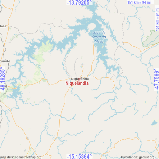
Niquelândia GPS coordinates[2]
14° 28' 26.004" South, 48° 27' 34.992" West
| Map corner | latitude | longitude |
|---|---|---|
| Upper-left | -13.79205°, | -49.16285° |
| Center: | -14.47389°, | -48.45972° |
| Lower-right: | -15.15364°, | -47.7566° |
| Map W x H: | 151.4×151.4 km | = 94.1×94.1mi |
| max Lat: | 2.81972° ⇑42.7% North |
| Niquelândia: | -14.47389° |
| min Lat: | ⇓57.3% South -33.69111° |
| min Long | Niquelândia | max Long |
| -72.89583° | -48.45972° | -32.41083° |
| W 33.3%⇐ | ⇒66.7% E |
Elevation
Elevation of Niquelândia is 580 m = 1903 ft, and this is 199.1 m = 653 ft above average elevation for this country.
| Max E: |
1603 m = 5259 ft | 29.4% |
| Niquelândia | 580 m 1903 ft | |
| Avg. | 380.9 m = 1250 ft | |
Min E: |
0 m = 0 ft | 70.6% |
See also: Brazil elevation on elevation.city.
Geographical zone
Niquelândia is located in South Torrid zone (between Equator and Tropic of Capricorn). Distance of this Southern Tropic circle is 996.6 km =619.3 mi to South.| Distance of | km | miles | from Niquelândia |
|---|---|---|---|
| Equator | 1609.3 | 1000 | to North |
| Tropic Capricorn | 996.6 | 619.3 | to South |
| Antarctic Circle | 5791.8 | 3598.9 | to South |
| South Pole | 8397.7 | 5218.1 | to South |


Nearby cities:
15 places around Niquelândia: (largest is in red/bold)
• Barro Alto
73.9 km =45.9 mi,  221°
221°
• Brasília
155.9 km =96.9 mi,  158°
158°
• Cavalcante
131.6 km =81.8 mi,  55°
55°
• Ceres
153.5 km =95.4 mi,  232°
232°
• Crixás
162.7 km =101.1 mi,  267°
267°
• Goianésia
117.4 km =72.9 mi, 216°
• Itapaci
128.6 km =79.9 mi,  245°
245°
• Minaçu
107.8 km =67 mi,  13°
13°
• Padre Bernardo
79.3 km =49.3 mi,  166°
166°
• Pirenópolis
162.3 km =100.8 mi,  199°
199°
• Planaltina
141.8 km =88.1 mi,  140°
140°
• Planaltina
154.2 km =95.8 mi,  145°
145°
• Porangatu
136.8 km =85 mi,  327°
327°
• Rialma
152.8 km =94.9 mi, 232°
• Uruaçu
73.5 km =45.7 mi, 265°
Sources, notices
• [Note1] Compared only with cities in Brazil existing in our database
• [Src1] Map data: © OpenStreetMap contributors (CC-BY-SA)
• [Src2] Other city data from geonames.org with taken over terms of usage.
• [Src3] Geographical zone / Annual Mean Temperature by Robert A. Rohde @ Wikipedia
