Barro Alto geodata
Barro Alto (Goiás) is a populated place; located in Brazil in America/Sao_Paulo (GMT-3) time zone. With population of 7,633 people, there are 1793 cities with bigger population in this country. Compared to other cities in Brazil, 56.1% of cities are located further ↓South; 70.9% of cities are located further →East and 73.3% of cities have lower elevation than Barro Alto. Note1


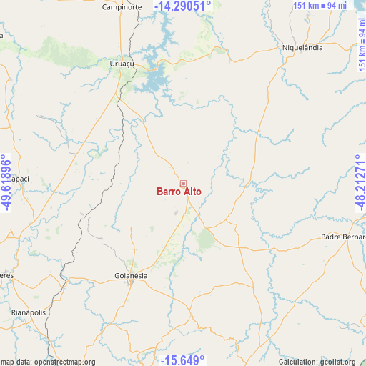
Barro Alto GPS coordinates[2]
14° 58' 14.988" South, 48° 54' 56.988" West
| Map corner | latitude | longitude |
|---|---|---|
| Upper-left | -14.29051°, | -49.61896° |
| Center: | -14.97083°, | -48.91583° |
| Lower-right: | -15.649°, | -48.21271° |
| Map W x H: | 151×151.1 km | = 93.8×93.9mi |
| max Lat: | 2.81972° ⇑43.9% North |
| Barro Alto: | -14.97083° |
| min Lat: | ⇓56.1% South -33.69111° |
| min Long | Barro Alto | max Long |
| -72.89583° | -48.91583° | -32.41083° |
| W 29.1%⇐ | ⇒70.9% E |
Elevation
Elevation of Barro Alto is 605 m = 1985 ft, and this is 224.1 m = 735 ft above average elevation for this country.
| Max E: |
1603 m = 5259 ft | 26.7% |
| Barro Alto | 605 m 1985 ft | |
| Avg. | 380.9 m = 1250 ft | |
Min E: |
0 m = 0 ft | 73.3% |
See also: Brazil elevation on elevation.city.
Geographical zone
Barro Alto is located in South Torrid zone (between Equator and Tropic of Capricorn). Distance of this Southern Tropic circle is 941.3 km =584.9 mi to South.| Distance of | km | miles | from Barro Alto |
|---|---|---|---|
| Equator | 1664.6 | 1034.3 | to North |
| Tropic Capricorn | 941.3 | 584.9 | to South |
| Antarctic Circle | 5736.6 | 3564.6 | to South |
| South Pole | 8342.5 | 5183.8 | to South |


Nearby cities:
15 places around Barro Alto: (largest is in red/bold)
• Carmo do Rio Verde
95 km =59 mi,  243°
243°
• Ceres
82.3 km =51.1 mi, 242°
• Crixás
122.6 km =76.2 mi,  292°
292°
• Goianésia
44.2 km =27.5 mi,  209°
209°
• Itapaci
68.1 km =42.3 mi,  271°
271°
• Itapuranga
128.8 km =80 mi, 239°
• Jaraguá
98.3 km =61.1 mi, 207°
• Niquelândia
73.9 km =45.9 mi,  41°
41°
• Padre Bernardo
71.3 km =44.3 mi,  107°
107°
• Petrolina de Goiás
132.9 km =82.6 mi,  199°
199°
• Pirenópolis
98 km =60.9 mi,  182°
182°
• Rialma
81.3 km =50.5 mi, 241°
• Rubiataba
97.7 km =60.7 mi,  257°
257°
• Uruana
101.4 km =63 mi,  234°
234°
• Uruaçu
55.2 km =34.3 mi,  333°
333°
Sources, notices
• [Note1] Compared only with cities in Brazil existing in our database
• [Src1] Map data: © OpenStreetMap contributors (CC-BY-SA)
• [Src2] Other city data from geonames.org with taken over terms of usage.
• [Src3] Geographical zone / Annual Mean Temperature by Robert A. Rohde @ Wikipedia
