São Paulo de Olivença geodata
São Paulo de Olivença (Amazonas) is a populated place; located in Brazil in America/Manaus (GMT-4) time zone. With population of 11,763 people, there are 1501 cities with bigger population in this country. Compared to other cities in Brazil, 94.1% of cities are located further ↓South; 99.4% of cities are located further →East and 75.7% of cities have higher elevation than São Paulo de Olivença. Note1


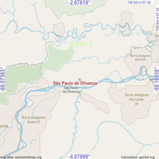
São Paulo de Olivença GPS coordinates[2]
3° 22' 41.988" South, 68° 52' 21" West
| Map corner | latitude | longitude |
|---|---|---|
| Upper-left | -2.67619°, | -69.57563° |
| Center: | -3.37833°, | -68.8725° |
| Lower-right: | -4.07996°, | -68.16938° |
| Map W x H: | 156.1×156.1 km | = 97×97mi |
| max Lat: | 2.81972° ⇑5.9% North |
| São Paulo de Olivença: | -3.37833° |
| min Lat: | ⇓94.1% South -33.69111° |
| min Long | São Paulo de O | max Long |
| -72.89583° | -68.8725° | -32.41083° |
| W 0.6%⇐ | ⇒99.4% E |
Elevation
Elevation of São Paulo de Olivença is 73 m = 240 ft, and this is 307.9 m = 1010 ft below average elevation for this country.
| Max E: |
1603 m = 5259 ft | 75.7% |
| Avg. | 380.9 m = 1250 ft | |
| São Paulo de Olivença | 73 m = 240 ft | |
Min E: |
0 m = 0 ft | 24.3% |
See also: Brazil elevation on elevation.city.
Geographical zone
São Paulo de Olivença is located in South Torrid zone (between Equator and Tropic of Capricorn). Distance of Equator is 375.6 km =233.4 mi to North.| Distance of | km | miles | from São Paulo de Olivença |
|---|---|---|---|
| Equator | 375.6 | 233.4 | to North |
| Tropic Capricorn | 2230.3 | 1385.8 | to South |
| Antarctic Circle | 7025.5 | 4365.4 | to South |
| South Pole | 9631.4 | 5984.7 | to South |


Nearby cities:
11 places around São Paulo de Olivença: (largest is in red/bold)
• Benjamin Constant
169.8 km =105.5 mi,  229°
229°
• Carauari
275.7 km =171.3 mi,  127°
127°
• Eirunepé
381.4 km =237 mi,  196°
196°
• Fonte Boa
323.4 km =201 mi,  72°
72°
• Jutaí
200.7 km =124.7 mi,  180°
180°
• Maraã
426.8 km =265.2 mi, 66°
• Santo Antônio do Içá
108 km =67.1 mi, 73°
• São Gabriel da Cachoeira
413.3 km =256.8 mi,  28°
28°
• Tabatinga
151.6 km =94.2 mi, 231°
• Tonantins
131.4 km =81.6 mi,  64°
64°
• Uarini
420.1 km =261 mi,  84°
84°
Sources, notices
• [Note1] Compared only with cities in Brazil existing in our database
• [Src1] Map data: © OpenStreetMap contributors (CC-BY-SA)
• [Src2] Other city data from geonames.org with taken over terms of usage.
• [Src3] Geographical zone / Annual Mean Temperature by Robert A. Rohde @ Wikipedia
