Matthew Town geodata
Matthew Town (Inagua) is a seat of a first-order administrative division; located in Bahamas in America/Nassau (GMT-4) time zone. With population of 452 people, there are 16 cities with bigger population in this country. Compared to other cities in Bahamas, 100% of cities are located further ↑North; 95.8% of cities are located further ←West and 70.8% of cities have lower elevation than Matthew Town. Note1


Matthew Town GPS coordinates[2]
20° 56' 59.352" North, 73° 40' 24.456" West
| Map corner | latitude | longitude |
|---|---|---|
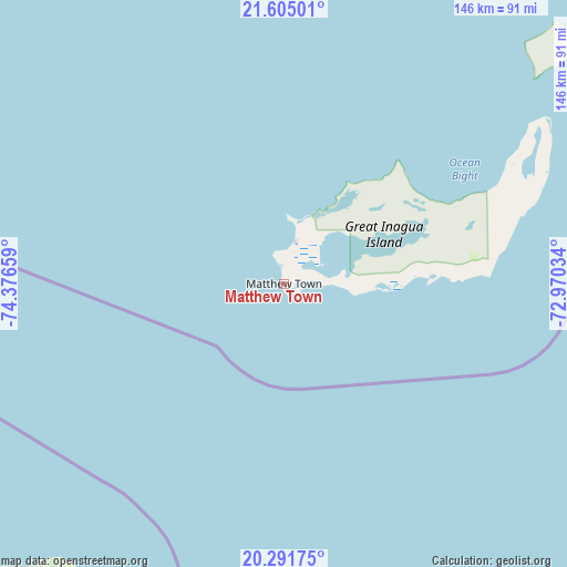
| Upper-left | 21.60501°, | -74.37659° |
| Center: | 20.94982°, | -73.67346° |
| Lower-right: | 20.29175°, | -72.97034° |
| Map W x H: | 146×146 km | = 90.7×90.7mi |
| max Lat: | 26.87137° ⇑100% North |
| Matthew Town: | 20.94982° |
| min Lat: | ⇓0% South 20.94982° |
| min Long | Matthew Town | max Long |
| -79.29721° | -73.67346° | -72.96667° |
| W 95.8%⇐ | ⇒4.2% E |
Elevation
Elevation of Matthew Town is 11 m = 36 ft, and this is 1.5 m = 5 ft above average elevation for this country.
| Max E: |
27 m = 89 ft | 29.2% |
| Matthew Town | 11 m 36 ft | |
| Avg. | 9.5 m = 31 ft | |
Min E: |
1 m = 3 ft | 70.8% |
See also: Bahamas elevation on elevation.city.
Geographical zone
Matthew Town is located in North Torrid zone (between Equator and Tropic of Cancer). Distance of this Northern Tropic circle is 276.5 km =171.8 mi to North.| Distance of | km | miles | from Matthew Town |
|---|---|---|---|
| North Pole | 7677.7 | 4770.7 | to North |
| Arctic Circle | 5071.8 | 3151.5 | to North |
| Tropic Cancer | 276.5 | 171.8 | to North |
| Equator | 2329.4 | 1447.4 | to South |


Nearby cities:
8 places around Matthew Town: (largest is in red/bold)
• Abraham’s Bay
173.6 km =107.9 mi,  24°
24°
• Clarence Town
274.6 km =170.6 mi,  330°
330°
• Cockburn Town
356 km =221.2 mi,  345°
345°
• Colonel Hill
208 km =129.2 mi,  344°
344°
• Duncan Town
253.1 km =157.3 mi,  303°
303°
• George Town
358.8 km =222.9 mi,  322°
322°
• Masons Bay
178.5 km =110.9 mi, 353°
• Port Nelson
323.3 km =200.9 mi, 338°
Sources, notices
• [Note1] Compared only with cities in Bahamas existing in our database
• [Src1] Map data: © OpenStreetMap contributors (CC-BY-SA)
• [Src2] Other city data from geonames.org with taken over terms of usage.
• [Src3] Geographical zone / Annual Mean Temperature by Robert A. Rohde @ Wikipedia
