Colonel Hill geodata
Colonel Hill (Crooked Island and Long Cay) is a seat of a first-order administrative division; located in Bahamas in America/Nassau (GMT-4) time zone. With population of 240 people, there are 17 cities with bigger population in this country. Compared to other cities in Bahamas, 83.3% of cities are located further ↑North; 87.5% of cities are located further ←West and 83.3% of cities have higher elevation than Colonel Hill. Note1


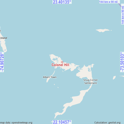
Colonel Hill GPS coordinates[2]
22° 45' 16.2" North, 74° 12' 14.94" West
| Map corner | latitude | longitude |
|---|---|---|
| Upper-left | 23.40135°, | -74.90728° |
| Center: | 22.7545°, | -74.20415° |
| Lower-right: | 22.10457°, | -73.50103° |
| Map W x H: | 144.2×144.2 km | = 89.6×89.6mi |
| max Lat: | 26.87137° ⇑83.3% North |
| Colonel Hill: | 22.7545° |
| min Lat: | ⇓16.7% South 20.94982° |
| min Long | Colonel Hill | max Long |
| -79.29721° | -74.20415° | -72.96667° |
| W 87.5%⇐ | ⇒12.5% E |
Elevation
Elevation of Colonel Hill is 5 m = 16 ft, and this is 4.5 m = 15 ft below average elevation for this country.
| Max E: |
27 m = 89 ft | 83.3% |
| Avg. | 9.5 m = 31 ft | |
| Colonel Hill | 5 m = 16 ft | |
Min E: |
1 m = 3 ft | 16.7% |
See also: Bahamas elevation on elevation.city.
Geographical zone
Colonel Hill is located in North Torrid zone (between Equator and Tropic of Cancer). Distance of this Northern Tropic circle is 75.9 km =47.2 mi to North.| Distance of | km | miles | from Colonel Hill |
|---|---|---|---|
| North Pole | 7477 | 4646 | to North |
| Arctic Circle | 4871.1 | 3026.8 | to North |
| Tropic Cancer | 75.9 | 47.2 | to North |
| Equator | 2530.1 | 1572.1 | to South |


Nearby cities:
14 places around Colonel Hill: (largest is in red/bold)
• Abraham’s Bay
134.2 km =83.4 mi,  108°
108°
• Arthur’s Town
255.8 km =158.9 mi,  324°
324°
• Black Point
268 km =166.5 mi,  303°
303°
• Clarence Town
88.6 km =55.1 mi, 295°
• Cockburn Town
148.1 km =92 mi,  346°
346°
• Duncan Town
168.4 km =104.6 mi,  248°
248°
• Dunmore Town
392.7 km =244 mi, 321°
• George Town
182.6 km =113.5 mi, 297°
• Governor’s Harbour
338.3 km =210.2 mi, 322°
• Masons Bay
40.9 km =25.4 mi,  125°
125°
• Matthew Town
208 km =129.2 mi,  164°
164°
• Nassau
409.1 km =254.2 mi,  308°
308°
• Port Nelson
119 km =73.9 mi,  326°
326°
• Spanish Wells
404.8 km =251.5 mi, 320°
Sources, notices
• [Note1] Compared only with cities in Bahamas existing in our database
• [Src1] Map data: © OpenStreetMap contributors (CC-BY-SA)
• [Src2] Other city data from geonames.org with taken over terms of usage.
• [Src3] Geographical zone / Annual Mean Temperature by Robert A. Rohde @ Wikipedia
