Duncan Town geodata
Duncan Town (Ragged Island) is a seat of a first-order administrative division; located in Bahamas in America/Nassau (GMT-4) time zone. With population of 70 people, there are 20 cities with bigger population in this country. Compared to other cities in Bahamas, 95.8% of cities are located further ↑North; 66.7% of cities are located further ←West and 100% of cities have lower elevation than Duncan Town. Note1


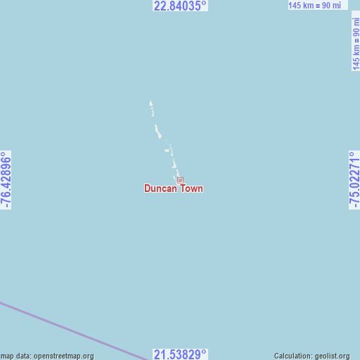
Duncan Town GPS coordinates[2]
22° 11' 26.988" North, 75° 43' 32.988" West
| Map corner | latitude | longitude |
|---|---|---|
| Upper-left | 22.84035°, | -76.42896° |
| Center: | 22.19083°, | -75.72583° |
| Lower-right: | 21.53829°, | -75.02271° |
| Map W x H: | 144.8×144.8 km | = 90×90mi |
| max Lat: | 26.87137° ⇑95.8% North |
| Duncan Town: | 22.19083° |
| min Lat: | ⇓4.2% South 20.94982° |
| min Long | Duncan Town | max Long |
| -79.29721° | -75.72583° | -72.96667° |
| W 66.7%⇐ | ⇒33.3% E |
Elevation
Elevation of Duncan Town is 27 m = 89 ft, and this is 17.5 m = 57 ft above average elevation for this country.
| Max E: |
27 m = 89 ft | 0% |
| Duncan Town | 27 m 89 ft | |
| Avg. | 9.5 m = 31 ft | |
Min E: |
1 m = 3 ft | 100% |
See also: Bahamas elevation on elevation.city.
Geographical zone
Duncan Town is located in North Torrid zone (between Equator and Tropic of Cancer). Distance of this Northern Tropic circle is 138.5 km =86.1 mi to North.| Distance of | km | miles | from Duncan Town |
|---|---|---|---|
| North Pole | 7539.7 | 4685 | to North |
| Arctic Circle | 4933.8 | 3065.7 | to North |
| Tropic Cancer | 138.5 | 86.1 | to North |
| Equator | 2467.4 | 1533.2 | to South |


Nearby cities:
15 places around Duncan Town: (largest is in red/bold)
• Abraham’s Bay
284.6 km =176.8 mi,  86°
86°
• Andros Town
348.7 km =216.7 mi,  323°
323°
• Arthur’s Town
270.4 km =168 mi,  1°
1°
• Black Point
222.7 km =138.4 mi,  342°
342°
• Clarence Town
126.6 km =78.7 mi,  37°
37°
• Cockburn Town
240.3 km =149.3 mi,  30°
30°
• Colonel Hill
168.4 km =104.6 mi,  68°
68°
• Dunmore Town
379.6 km =235.9 mi,  345°
345°
• George Town
147.5 km =91.7 mi,  357°
357°
• Governor’s Harbour
334.9 km =208.1 mi, 351°
• Masons Bay
194 km =120.5 mi,  78°
78°
• Matthew Town
253.1 km =157.3 mi,  123°
123°
• Nassau
358.9 km =223 mi,  332°
332°
• Port Nelson
185.8 km =115.5 mi, 29°
• Spanish Wells
387.8 km =241 mi, 344°
Sources, notices
• [Note1] Compared only with cities in Bahamas existing in our database
• [Src1] Map data: © OpenStreetMap contributors (CC-BY-SA)
• [Src2] Other city data from geonames.org with taken over terms of usage.
• [Src3] Geographical zone / Annual Mean Temperature by Robert A. Rohde @ Wikipedia
