Masons Bay geodata
Masons Bay (Acklins) is a seat of a first-order administrative division; located in Bahamas in America/Nassau (GMT-4) time zone. In our database, there are 21 cities with bigger population. Compared to other cities in Bahamas, 87.5% of cities are located further ↑North; 91.7% of cities are located further ←West and 66.7% of cities have higher elevation than Masons Bay. Note1


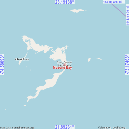
Masons Bay GPS coordinates[2]
22° 32' 36.672" North, 73° 52' 40.08" West
| Map corner | latitude | longitude |
|---|---|---|
| Upper-left | 23.19138°, | -74.58093° |
| Center: | 22.54352°, | -73.8778° |
| Lower-right: | 21.89261°, | -73.17468° |
| Map W x H: | 144.4×144.4 km | = 89.7×89.7mi |
| max Lat: | 26.87137° ⇑87.5% North |
| Masons Bay: | 22.54352° |
| min Lat: | ⇓12.5% South 20.94982° |
| min Long | Masons Bay | max Long |
| -79.29721° | -73.8778° | -72.96667° |
| W 91.7%⇐ | ⇒8.3% E |
Elevation
Elevation of Masons Bay is 6 m = 20 ft, and this is 3.5 m = 11 ft below average elevation for this country.
| Max E: |
27 m = 89 ft | 66.7% |
| Avg. | 9.5 m = 31 ft | |
| Masons Bay | 6 m = 20 ft | |
Min E: |
1 m = 3 ft | 33.3% |
See also: Bahamas elevation on elevation.city.
Geographical zone
Masons Bay is located in North Torrid zone (between Equator and Tropic of Cancer). Distance of this Northern Tropic circle is 99.3 km =61.7 mi to North.| Distance of | km | miles | from Masons Bay |
|---|---|---|---|
| North Pole | 7500.5 | 4660.6 | to North |
| Arctic Circle | 4894.6 | 3041.4 | to North |
| Tropic Cancer | 99.3 | 61.7 | to North |
| Equator | 2506.6 | 1557.5 | to South |


Nearby cities:
11 places around Masons Bay: (largest is in red/bold)
• Abraham’s Bay
95.7 km =59.5 mi,  101°
101°
• Arthur’s Town
294.7 km =183.1 mi,  321°
321°
• Black Point
308.9 km =191.9 mi,  304°
304°
• Clarence Town
129.1 km =80.2 mi, 298°
• Cockburn Town
180.5 km =112.2 mi,  338°
338°
• Colonel Hill
40.9 km =25.4 mi,  305°
305°
• Duncan Town
194 km =120.5 mi,  258°
258°
• George Town
223.3 km =138.8 mi, 298°
• Governor’s Harbour
377.4 km =234.5 mi, 320°
• Matthew Town
178.5 km =110.9 mi,  173°
173°
• Port Nelson
157.6 km =97.9 mi, 321°
Sources, notices
• [Note1] Compared only with cities in Bahamas existing in our database
• [Src1] Map data: © OpenStreetMap contributors (CC-BY-SA)
• [Src2] Other city data from geonames.org with taken over terms of usage.
• [Src3] Geographical zone / Annual Mean Temperature by Robert A. Rohde @ Wikipedia
