Clarence Town geodata
Clarence Town (Long Island) is a seat of a first-order administrative division; located in Bahamas in America/Nassau (GMT-4) time zone. With population of 1,752 people, there are 10 cities with bigger population in this country. Compared to other cities in Bahamas, 79.2% of cities are located further ↑North; 75% of cities are located further ←West and 95.8% of cities have lower elevation than Clarence Town. Note1


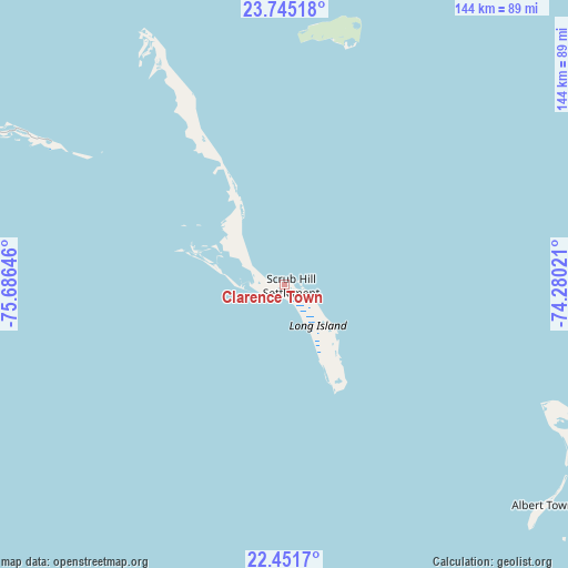
Clarence Town GPS coordinates[2]
23° 6' 0" North, 74° 58' 59.988" West
| Map corner | latitude | longitude |
|---|---|---|
| Upper-left | 23.74518°, | -75.68646° |
| Center: | 23.1°, | -74.98333° |
| Lower-right: | 22.4517°, | -74.28021° |
| Map W x H: | 143.8×143.8 km | = 89.4×89.4mi |
| max Lat: | 26.87137° ⇑79.2% North |
| Clarence Town: | 23.1° |
| min Lat: | ⇓20.8% South 20.94982° |
| min Long | Clarence Town | max Long |
| -79.29721° | -74.98333° | -72.96667° |
| W 75%⇐ | ⇒25% E |
Elevation
Elevation of Clarence Town is 20 m = 66 ft, and this is 10.5 m = 34 ft above average elevation for this country.
| Max E: |
27 m = 89 ft | 4.2% |
| Clarence Town | 20 m 66 ft | |
| Avg. | 9.5 m = 31 ft | |
Min E: |
1 m = 3 ft | 95.8% |
See also: Bahamas elevation on elevation.city.
Geographical zone
Clarence Town is located in North Torrid zone (between Equator and Tropic of Cancer). Distance of this Northern Tropic circle is 37.4 km =23.2 mi to North.| Distance of | km | miles | from Clarence Town |
|---|---|---|---|
| North Pole | 7438.6 | 4622.1 | to North |
| Arctic Circle | 4832.7 | 3002.9 | to North |
| Tropic Cancer | 37.4 | 23.2 | to North |
| Equator | 2568.5 | 1596 | to South |


Nearby cities:
15 places around Clarence Town: (largest is in red/bold)
• Abraham’s Bay
222.3 km =138.1 mi,  111°
111°
• Andros Town
334.7 km =208 mi,  302°
302°
• Arthur’s Town
183.2 km =113.8 mi,  337°
337°
• Black Point
180.9 km =112.4 mi,  307°
307°
• Cockburn Town
115.4 km =71.7 mi,  23°
23°
• Colonel Hill
88.6 km =55.1 mi,  115°
115°
• Duncan Town
126.6 km =78.7 mi,  217°
217°
• Dunmore Town
315.3 km =195.9 mi,  327°
327°
• George Town
94.2 km =58.5 mi, 299°
• Governor’s Harbour
262.5 km =163.1 mi, 331°
• Masons Bay
129.1 km =80.2 mi, 118°
• Matthew Town
274.6 km =170.6 mi,  150°
150°
• Nassau
323.7 km =201.1 mi, 312°
• Port Nelson
62.8 km =39 mi,  13°
13°
• Spanish Wells
326.5 km =202.9 mi, 326°
Sources, notices
• [Note1] Compared only with cities in Bahamas existing in our database
• [Src1] Map data: © OpenStreetMap contributors (CC-BY-SA)
• [Src2] Other city data from geonames.org with taken over terms of usage.
• [Src3] Geographical zone / Annual Mean Temperature by Robert A. Rohde @ Wikipedia
