Sainte-Thérèse geodata
Sainte-Thérèse (Quebec) is a populated place; located in Canada in America/Toronto (GMT-4) time zone. With population of 25,224 people, there are 160 cities with bigger population in this country. Compared to other cities in Canada, 70.9% of cities are located further ↑North; 64.4% of cities are located further ←West and 77.7% of cities have higher elevation than Sainte-Thérèse. Note1


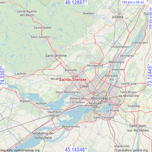
Sainte-Thérèse GPS coordinates[2]
45° 38' 21.192" North, 73° 49' 39.252" West
| Map corner | latitude | longitude |
|---|---|---|
| Upper-left | 46.12867°, | -74.5307° |
| Center: | 45.63922°, | -73.82757° |
| Lower-right: | 45.14546°, | -73.12445° |
| Map W x H: | 109.3×109.3 km | = 67.9×67.9mi |
| max Lat: | 73.03752° ⇑70.9% North |
| Sainte-Thérèse: | 45.63922° |
| min Lat: | ⇓29.1% South 42.05009° |
| min Long | Sainte-Thérès | max Long |
| -139.43328° | -73.82757° | -52.70931° |
| W 64.4%⇐ | ⇒35.6% E |
Elevation
Elevation of Sainte-Thérèse is 36 m = 118 ft, and this is 218.4 m = 717 ft below average elevation for this country.
| Max E: |
1518 m = 4980 ft | 77.7% |
| Avg. | 254.4 m = 835 ft | |
| Sainte-Thérèse | 36 m = 118 ft | |
Min E: |
-2 m = -7 ft | 22.3% |
See also: Canada elevation on elevation.city.
Geographical zone
Sainte-Thérèse is located in North temperate zone (between Tropic of Cancer and the Arctic Circle). Distance of this North polar circle is 2326.6 km =1445.7 mi to North.| Distance of | km | miles | from Sainte-Thérèse |
|---|---|---|---|
| North Pole | 4932.5 | 3064.9 | to North |
| Arctic Circle | 2326.6 | 1445.7 | to North |
| Tropic Cancer | 2468.7 | 1534 | to South |
| Equator | 5074.6 | 3153.2 | to South |


Nearby cities:
15 places around Sainte-Thérèse: (largest is in red/bold)
• Blainville
5.3 km =3.3 mi,  305°
305°
• Bois-des-Filion
6.8 km =4.2 mi,  63°
63°
• Boisbriand
2.5 km =1.6 mi,  188°
188°
• Deux-Montagnes
13 km =8.1 mi,  206°
206°
• Dollard-Des Ormeaux
16.1 km =10 mi,  179°
179°
• Laval
13.1 km =8.1 mi,  126°
126°
• Lorraine
6 km =3.7 mi,  35°
35°
• Rosemère
2.3 km =1.4 mi,  106°
106°
• Saint-Elzéar
8.8 km =5.5 mi,  116°
116°
• Saint-Eustache
10.2 km =6.3 mi,  216°
216°
• Saint-Joseph-du-Lac
17.8 km =11.1 mi,  228°
228°
• Saint-Michel
17.9 km =11.1 mi, 116°
• Sainte-Anne-des-Plaines
14 km =8.7 mi,  5°
5°
• Sainte-Marthe-sur-le-Lac
14.3 km =8.9 mi, 214°
• Terrebonne
15.6 km =9.7 mi, 64°
Sources, notices
• [Note1] Compared only with cities in Canada existing in our database
• [Src1] Map data: © OpenStreetMap contributors (CC-BY-SA)
• [Src2] Other city data from geonames.org with taken over terms of usage.
• [Src3] Geographical zone / Annual Mean Temperature by Robert A. Rohde @ Wikipedia
