St-Jean-Port-Joli geodata
St-Jean-Port-Joli (Quebec) is a populated place; located in Canada in America/Toronto (GMT-4) time zone. With population of 3,304 people, there are 582 cities with bigger population in this country. Compared to other cities in Canada, 50.9% of cities are located further ↑North; 82.5% of cities are located further ←West and 96% of cities have higher elevation than St-Jean-Port-Joli. Note1
Administrative division(s):
- Level 1: Quebec
- Level 2: Chaudière-Appalaches
- Level 3: Saint-Jean-Port-Joli


St-Jean-Port-Joli GPS coordinates[2]
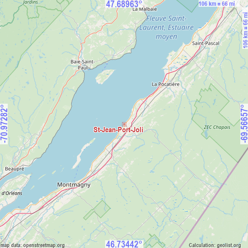
47° 12' 51.048" North, 70° 16' 10.884" West
| Map corner | latitude | longitude |
|---|---|---|
| Upper-left | 47.68963°, | -70.97282° |
| Center: | 47.21418°, | -70.26969° |
| Lower-right: | 46.73442°, | -69.56657° |
| Map W x H: | 106.2×106.2 km | = 66×66mi |
| max Lat: | 73.03752° ⇑50.9% North |
| St-Jean-Port-Joli: | 47.21418° |
| min Lat: | ⇓49.1% South 42.05009° |
| min Long | St-Jean-Port-Jo | max Long |
| -139.43328° | -70.26969° | -52.70931° |
| W 82.5%⇐ | ⇒17.5% E |
Elevation
Elevation of St-Jean-Port-Joli is 7 m = 23 ft, and this is 247.4 m = 812 ft below average elevation for this country.
| Max E: |
1518 m = 4980 ft | 96% |
| Avg. | 254.4 m = 835 ft | |
| St-Jean-Port-Joli | 7 m = 23 ft | |
Min E: |
-2 m = -7 ft | 4% |
See also: Canada elevation on elevation.city.
Geographical zone
St-Jean-Port-Joli is located in North temperate zone (between Tropic of Cancer and the Arctic Circle). Distance of this North polar circle is 2151.4 km =1336.8 mi to North.| Distance of | km | miles | from St-Jean-Port-Joli |
|---|---|---|---|
| North Pole | 4757.3 | 2956 | to North |
| Arctic Circle | 2151.4 | 1336.8 | to North |
| Tropic Cancer | 2643.8 | 1642.8 | to South |
| Equator | 5249.7 | 3262 | to South |


Nearby cities:
15 places around St-Jean-Port-Joli: (largest is in red/bold)
• Baie-Saint-Paul
30.6 km =19 mi,  325°
325°
• Beaupré
51 km =31.7 mi,  248°
248°
• Château-Richer
64.3 km =40 mi,  243°
243°
• Kamouraska
49.5 km =30.8 mi,  37°
37°
• L'Ange-Gardien
69.7 km =43.3 mi, 241°
• La Malbaie
49.7 km =30.9 mi,  10°
10°
• La Pocatière
24.6 km =15.3 mi,  46°
46°
• Lévis
82.6 km =51.3 mi, 236°
• Montmagny
33.8 km =21 mi,  219°
219°
• Pohénégamook
83.3 km =51.8 mi,  70°
70°
• Saint-André
66 km =41 mi, 38°
• Saint-Bernard-de-l'Île-aux-Coudres
26.2 km =16.3 mi,  231°
231°
• Saint-Pacôme
32.1 km =19.9 mi, 48°
• Saint-Pascal
48.8 km =30.3 mi, 46°
• Saint-Siméon
76 km =47.2 mi,  22°
22°
Sources, notices
• [Note1] Compared only with cities in Canada existing in our database
• [Src1] Map data: © OpenStreetMap contributors (CC-BY-SA)
• [Src2] Other city data from geonames.org with taken over terms of usage.
• [Src3] Geographical zone / Annual Mean Temperature by Robert A. Rohde @ Wikipedia
