Chandler geodata
Chandler (Quebec) is a populated place; located in Canada in America/Toronto (GMT-4) time zone. With population of 7,914 people, there are 370 cities with bigger population in this country. Compared to other cities in Canada, 55.8% of cities are located further ↓South; 91.8% of cities are located further ←West and 88.3% of cities have higher elevation than Chandler. Note1
Administrative division(s):
- Level 1: Quebec
- Level 2: Gaspésie-Îles-de-la-Madeleine
- Level 3: Chandler


Chandler GPS coordinates[2]
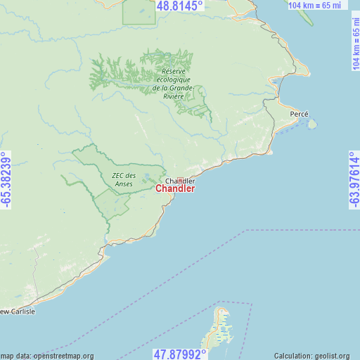
48° 20' 57.66" North, 64° 40' 45.336" West
| Map corner | latitude | longitude |
|---|---|---|
| Upper-left | 48.8145°, | -65.38239° |
| Center: | 48.34935°, | -64.67926° |
| Lower-right: | 47.87992°, | -63.97614° |
| Map W x H: | 103.9×103.9 km | = 64.6×64.6mi |
| max Lat: | 73.03752° ⇑44.2% North |
| Chandler: | 48.34935° |
| min Lat: | ⇓55.8% South 42.05009° |
| min Long | Chandler | max Long |
| -139.43328° | -64.67926° | -52.70931° |
| W 91.8%⇐ | ⇒8.2% E |
Elevation
Elevation of Chandler is 17 m = 56 ft, and this is 237.4 m = 779 ft below average elevation for this country.
| Max E: |
1518 m = 4980 ft | 88.3% |
| Avg. | 254.4 m = 835 ft | |
| Chandler | 17 m = 56 ft | |
Min E: |
-2 m = -7 ft | 11.7% |
See also: Canada elevation on elevation.city.
Geographical zone
Chandler is located in North temperate zone (between Tropic of Cancer and the Arctic Circle). Distance of this North polar circle is 2025.2 km =1258.4 mi to North.| Distance of | km | miles | from Chandler |
|---|---|---|---|
| North Pole | 4631.1 | 2877.6 | to North |
| Arctic Circle | 2025.2 | 1258.4 | to North |
| Tropic Cancer | 2770 | 1721.2 | to South |
| Equator | 5375.9 | 3340.4 | to South |


Nearby cities:
15 places around Chandler: (largest is in red/bold)
• Bonaventure
69.1 km =42.9 mi,  240°
240°
• Gaspé
55.7 km =34.6 mi,  15°
15°
• Haut-Sheila
69.2 km =43 mi,  194°
194°
• Maisonnette
63.1 km =39.2 mi,  202°
202°
• Miscou
45.8 km =28.5 mi,  169°
169°
• Murdochville
90.7 km =56.4 mi,  318°
318°
• New Carlisle
61.6 km =38.3 mi,  232°
232°
• New-Richmond
89.8 km =55.8 mi,  256°
256°
• Petit-Rocher-Nord
98.6 km =61.3 mi, 232°
• Saint Irénée and Alderwood
97.3 km =60.5 mi, 193°
• Saint-Simon
69.2 km =43 mi, 190°
• Sainte-Cécile
55 km =34.2 mi,  178°
178°
• Saumarez
96.4 km =59.9 mi, 191°
• Shippagan
67.3 km =41.8 mi, 181°
• Tracadie-Sheila
94.5 km =58.7 mi, 190°
Sources, notices
• [Note1] Compared only with cities in Canada existing in our database
• [Src1] Map data: © OpenStreetMap contributors (CC-BY-SA)
• [Src2] Other city data from geonames.org with taken over terms of usage.
• [Src3] Geographical zone / Annual Mean Temperature by Robert A. Rohde @ Wikipedia
