Campbellton geodata
Campbellton (New Brunswick) is a populated place; located in Canada in America/Moncton (GMT-3) time zone. With population of 7,384 people, there are 387 cities with bigger population in this country. Compared to other cities in Canada, 54.3% of cities are located further ↓South; 86.7% of cities are located further ←West and 94.5% of cities have higher elevation than Campbellton. Note1


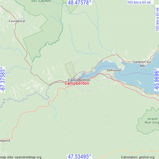
Campbellton GPS coordinates[2]
48° 0' 27.036" North, 66° 40' 21.792" West
| Map corner | latitude | longitude |
|---|---|---|
| Upper-left | 48.47578°, | -67.37585° |
| Center: | 48.00751°, | -66.67272° |
| Lower-right: | 47.53495°, | -65.9696° |
| Map W x H: | 104.6×104.6 km | = 65×65mi |
| max Lat: | 73.03752° ⇑45.7% North |
| Campbellton: | 48.00751° |
| min Lat: | ⇓54.3% South 42.05009° |
| min Long | Campbellton | max Long |
| -139.43328° | -66.67272° | -52.70931° |
| W 86.7%⇐ | ⇒13.3% E |
Elevation
Elevation of Campbellton is 9 m = 30 ft, and this is 245.4 m = 805 ft below average elevation for this country.
| Max E: |
1518 m = 4980 ft | 94.5% |
| Avg. | 254.4 m = 835 ft | |
| Campbellton | 9 m = 30 ft | |
Min E: |
-2 m = -7 ft | 5.5% |
See also: Canada elevation on elevation.city.
Geographical zone
Campbellton is located in North temperate zone (between Tropic of Cancer and the Arctic Circle). Distance of this North polar circle is 2063.2 km =1282 mi to North.| Distance of | km | miles | from Campbellton |
|---|---|---|---|
| North Pole | 4669.1 | 2901.2 | to North |
| Arctic Circle | 2063.2 | 1282 | to North |
| Tropic Cancer | 2732 | 1697.6 | to South |
| Equator | 5337.9 | 3316.8 | to South |


Nearby cities:
15 places around Campbellton: (largest is in red/bold)
• Amqui
75.7 km =47 mi,  312°
312°
• Bathurst
87.7 km =54.5 mi,  119°
119°
• Bonaventure
87.9 km =54.6 mi,  87°
87°
• Carleton
43.7 km =27.2 mi,  76°
76°
• Carleton-sur-Mer
42 km =26.1 mi,  74°
74°
• Dunlop
78.6 km =48.8 mi, 116°
• Lorne
43.3 km =26.9 mi,  110°
110°
• Maria
54.3 km =33.7 mi, 69°
• Matane
110.7 km =68.8 mi,  325°
325°
• New Carlisle
99.4 km =61.8 mi, 89°
• New-Richmond
62.8 km =39 mi, 74°
• Nicholas Denys
68.4 km =42.5 mi, 120°
• North Tetagouche
79.8 km =49.6 mi, 121°
• Petit-Rocher-Nord
73.5 km =45.7 mi, 107°
• Robertville
75.5 km =46.9 mi, 117°
Sources, notices
• [Note1] Compared only with cities in Canada existing in our database
• [Src1] Map data: © OpenStreetMap contributors (CC-BY-SA)
• [Src2] Other city data from geonames.org with taken over terms of usage.
• [Src3] Geographical zone / Annual Mean Temperature by Robert A. Rohde @ Wikipedia
