Jonquière geodata
Jonquière (Quebec) is a section of populated place; located in Canada in America/Toronto (GMT-4) time zone. With population of 54,842 people, there are 96 cities with bigger population in this country. Compared to other cities in Canada, 56.6% of cities are located further ↓South; 80.1% of cities are located further ←West and 54.7% of cities have higher elevation than Jonquière. Note1


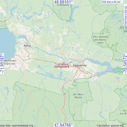
Jonquière GPS coordinates[2]
48° 24' 59.328" North, 71° 14' 55.824" West
| Map corner | latitude | longitude |
|---|---|---|
| Upper-left | 48.88101°, | -71.95197° |
| Center: | 48.41648°, | -71.24884° |
| Lower-right: | 47.94766°, | -70.54572° |
| Map W x H: | 103.8×103.8 km | = 64.5×64.5mi |
| max Lat: | 73.03752° ⇑43.4% North |
| Jonquière: | 48.41648° |
| min Lat: | ⇓56.6% South 42.05009° |
| min Long | Jonquière | max Long |
| -139.43328° | -71.24884° | -52.70931° |
| W 80.1%⇐ | ⇒19.9% E |
Elevation
Elevation of Jonquière is 142 m = 466 ft, and this is 112.4 m = 369 ft below average elevation for this country.
| Max E: |
1518 m = 4980 ft | 54.7% |
| Avg. | 254.4 m = 835 ft | |
| Jonquière | 142 m = 466 ft | |
Min E: |
-2 m = -7 ft | 45.3% |
See also: Jonquière elevation on elevation.city.
Geographical zone
Jonquière is located in North temperate zone (between Tropic of Cancer and the Arctic Circle). Distance of this North polar circle is 2017.8 km =1253.8 mi to North.| Distance of | km | miles | from Jonquière |
|---|---|---|---|
| North Pole | 4623.7 | 2873 | to North |
| Arctic Circle | 2017.8 | 1253.8 | to North |
| Tropic Cancer | 2777.5 | 1725.9 | to South |
| Equator | 5383.4 | 3345.1 | to South |


Nearby cities:
15 places around Jonquière: (largest is in red/bold)
• Alma
33 km =20.5 mi,  296°
296°
• Chambord
60.3 km =37.5 mi,  271°
271°
• L'Ascension-de-Notre-Seigneur
42.7 km =26.5 mi,  314°
314°
• Metabetchouan-Lac-a-la-Croix
39.2 km =24.4 mi, 268°
• Métabetchouan
56.9 km =35.4 mi,  264°
264°
• Pointe-du-Lac
40.4 km =25.1 mi,  283°
283°
• Pont Rouge
80.3 km =49.9 mi, 310°
• Roberval
73.4 km =45.6 mi, 278°
• Saguenay
13.5 km =8.4 mi,  89°
89°
• Saint-Ambroise
16.1 km =10 mi,  337°
337°
• Saint-Bruno
30 km =18.6 mi, 280°
• Saint-Charles-de-Bourget
18.8 km =11.7 mi,  332°
332°
• Saint-Gédéon
39.2 km =24.4 mi, 283°
• Saint-Honoré
17.9 km =11.1 mi,  43°
43°
• Saint-Nazaire
29.5 km =18.3 mi, 310°
Sources, notices
• [Note1] Compared only with cities in Canada existing in our database
• [Src1] Map data: © OpenStreetMap contributors (CC-BY-SA)
• [Src2] Other city data from geonames.org with taken over terms of usage.
• [Src3] Geographical zone / Annual Mean Temperature by Robert A. Rohde @ Wikipedia
